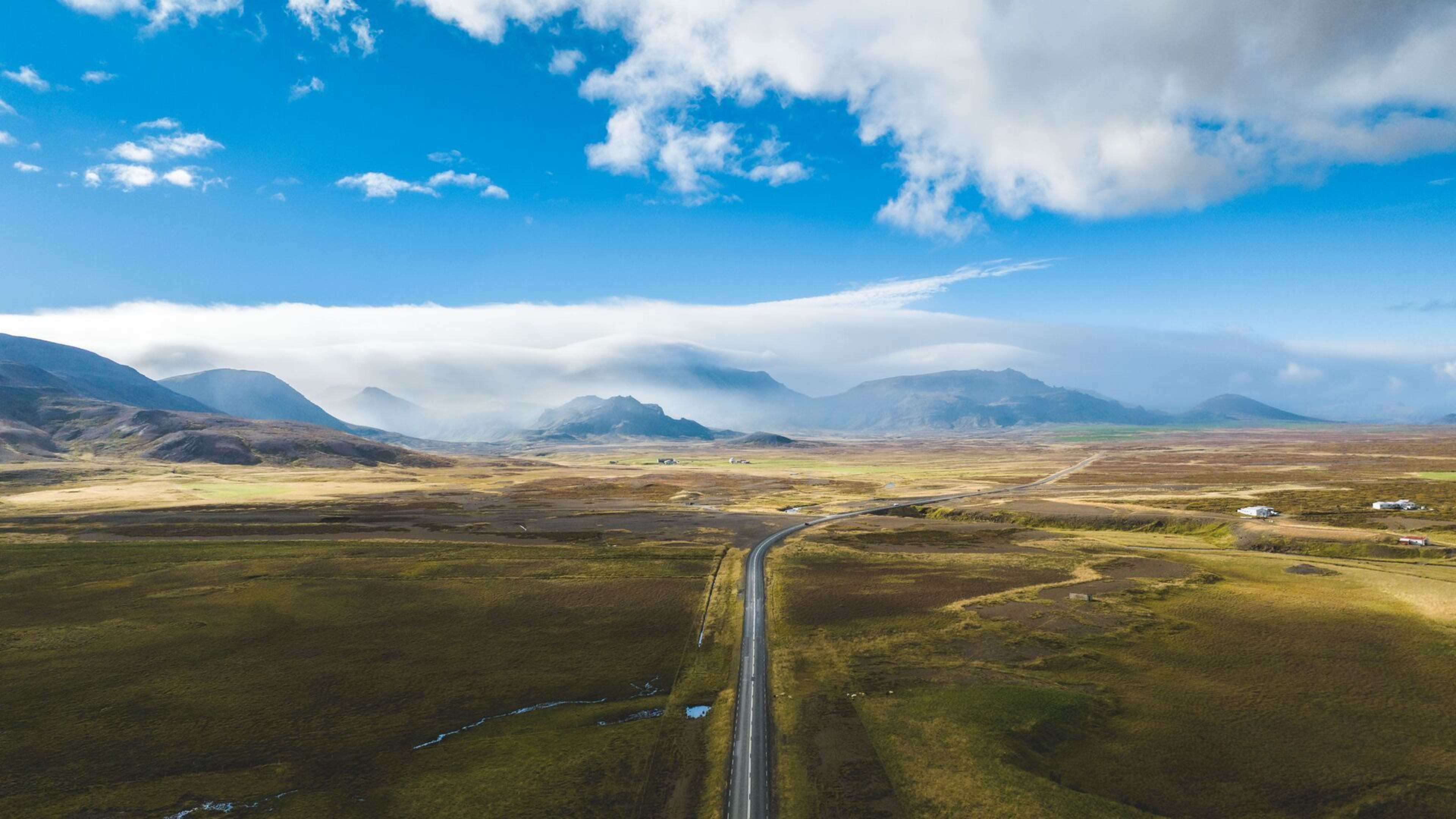
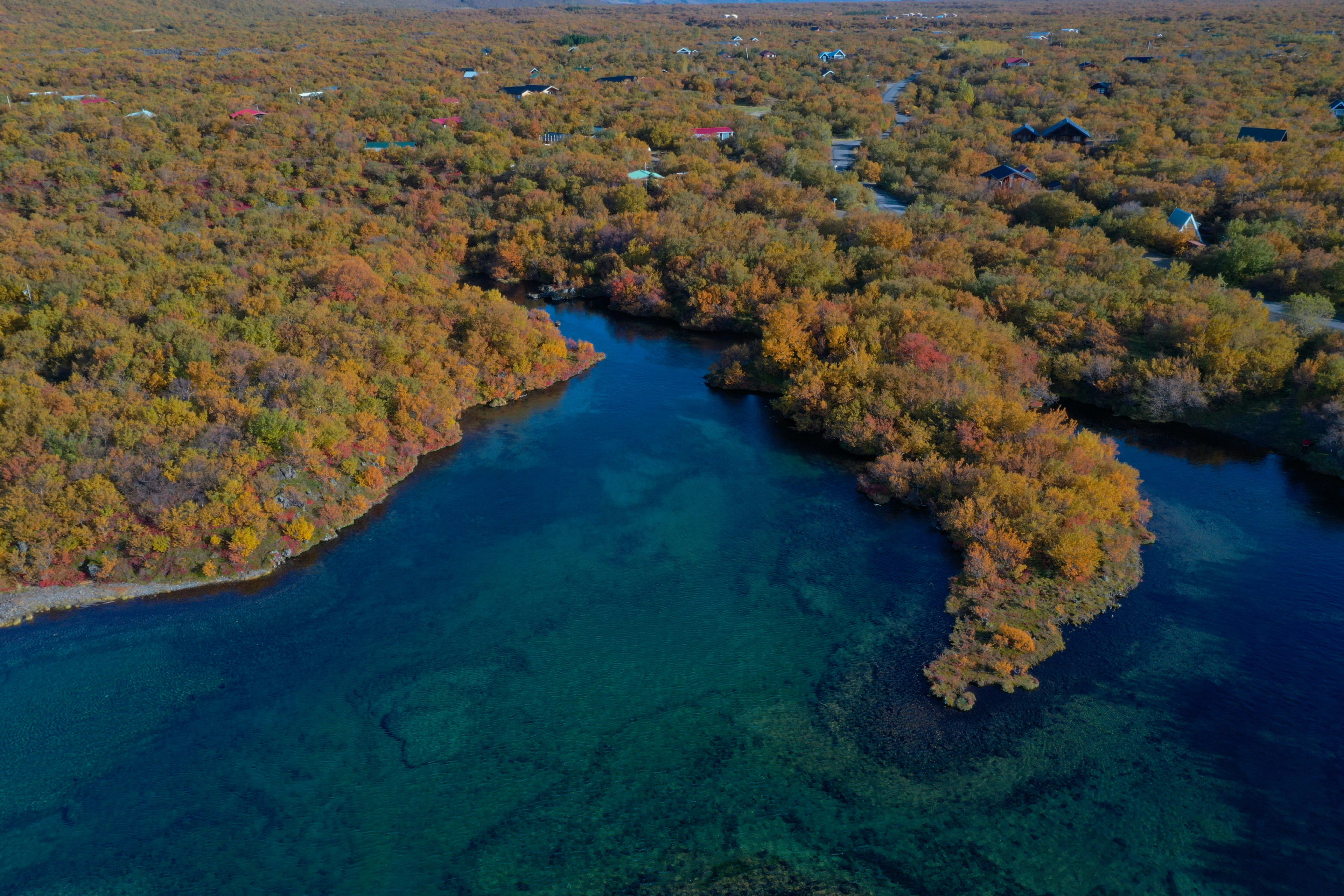
As Iceland's mystique is gradually unveiled, this island, surrounded by mysterious black sand beaches, misty active volcanoes, deep ice caves, magnificent glacial lagoons, and the dreamlike Northern Lights, has become a mecca for countless travelers. Popular attractions such as the Blue Lagoon, the Golden Circle, and the Snæfellsnes Peninsula attract hundreds of thousands of tourists every year. However, Iceland's beauty extends far beyond these well-known landmarks. Many hidden gems await discovery. When traveling to Iceland, if you take the plunge and explore its less-traveled destinations, you'll create a truly authentic Icelandic journey that's uniquely yours! So, what are some of Iceland's lesser-known attractions worth visiting? Let's take a look!
Imagine admiring murals by local artists in a secluded church in Iceland; discovering a hidden waterfall known only to locals deep in a canyon; or soaking in warm spring waters of a hidden gem, experiencing Iceland's unique geothermal wonders… The best way to reach these lesser-known Icelandic destinations is by car. You'll rent a car, manage your own time, and control your own itinerary. Why not check out the island-wide self-drive packages offered by Forest Cat Travel?
Southern Iceland
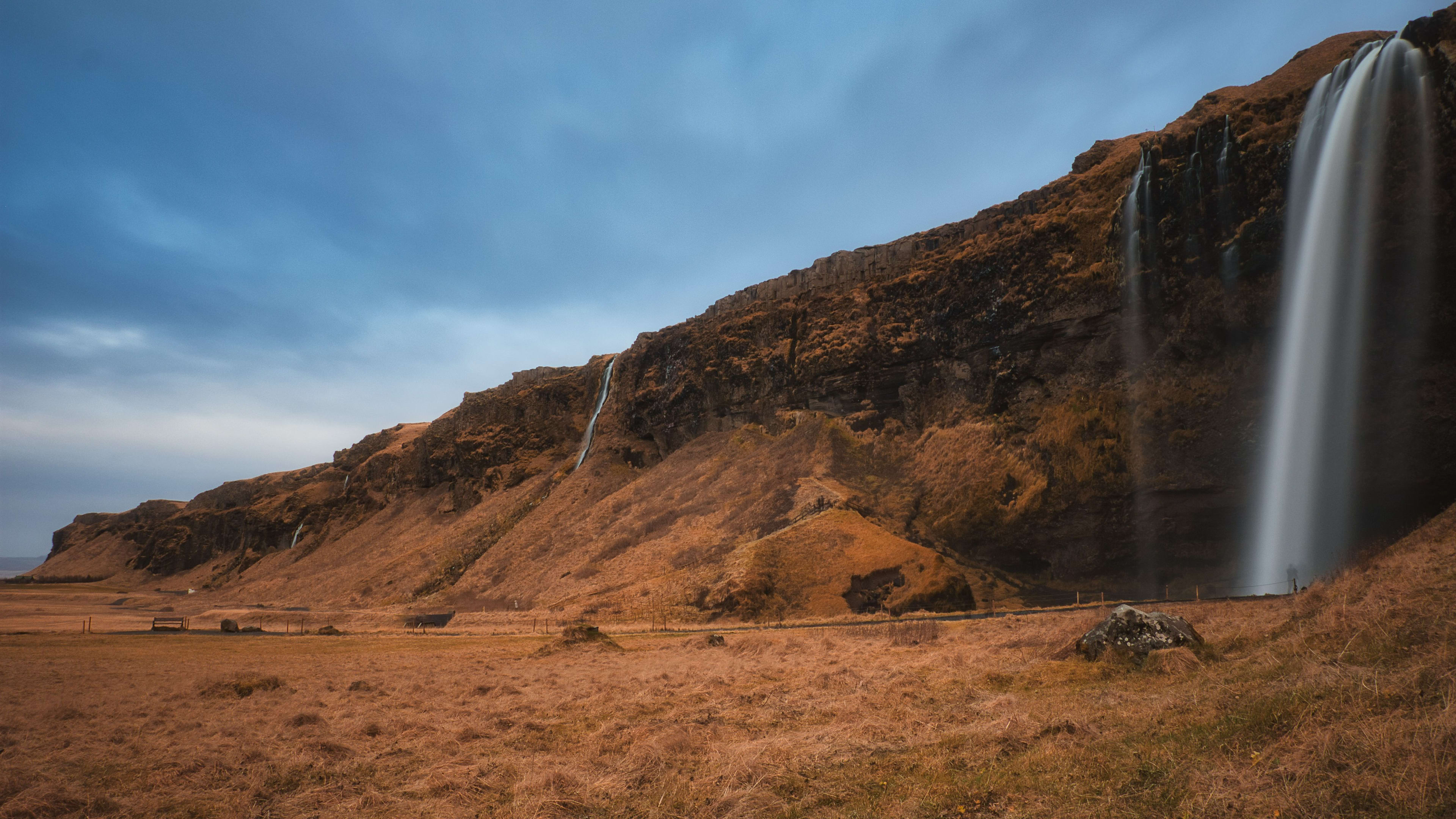
Seljavallalaug Mountain Secret Hot Spring Pool
Reason for inclusion: Seljavallalaug, a secluded mountain hot spring pool, was built in 1923 and is considered one of Iceland's oldest swimming pools. While it has gained popularity in recent years, its location near the famous Eyjafjallajökull volcano , nestled among stunning mountains and beautiful valleys, still requires some exploration to reach and remains relatively remote. However, compared to many other pools in Iceland, it offers a more private experience. Upon arrival, there is a changing room available. After showering and changing into your swimsuit, you can jump into the pool and enjoy the healing power of nature in this secluded mountain retreat!
Location information: Approximately 10 kilometers east of the town of Ásólfsskáli.
How to get there: From the capital, drive east along Highway 1 for 1.5 hours, turn onto Highway 242 to reach a parking lot, and walk north for 20 minutes along the picturesque river and lush green landscape.
Visitor Precautions: The pool may become very slippery due to the year-round algae growth, so please be careful! In addition, this pool is only cleaned once a year, and the stagnant water may harbor various bacteria, which can easily irritate sensitive skin.
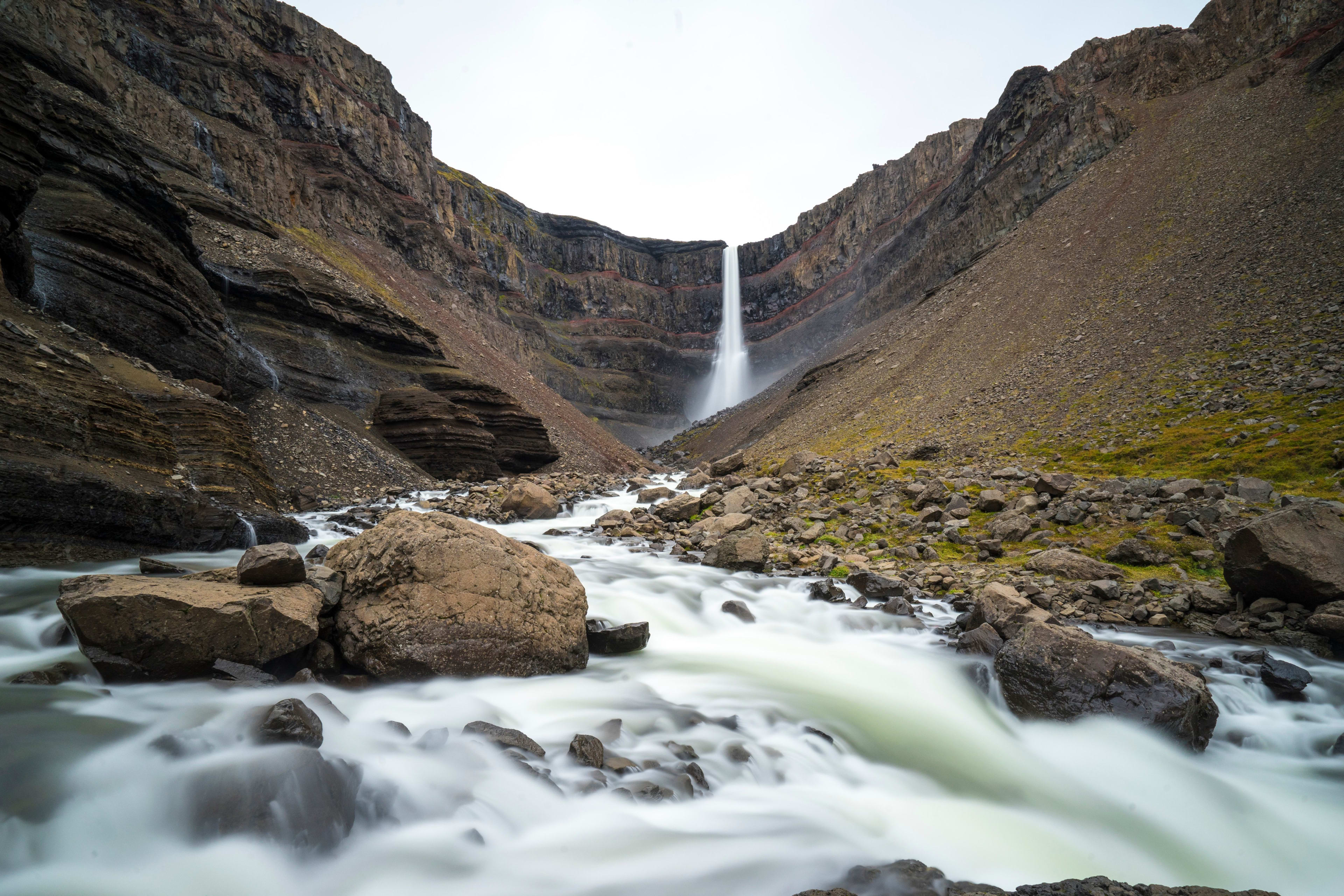
Stjórnarfoss Waterfall
Reason for inclusion: Stjórnarfoss Waterfall, nestled near the quaint southern Icelandic town of Kirkjubæjarklaustur , is one of Iceland's true hidden gems. The waterfall cascades down 15 meters into a tranquil pool. The dome-shaped cliff makes the lower tier more prominent than the upper one. Standing close to the water, the upper tier is difficult to see.
The moss-covered volcanic rocks that frame the waterfall add to the idyllic scenery, making it perfect for family picnics or a quiet retreat for one. For outdoor enthusiasts, camping at the nearby Kleifar Campsite offers an even more unique and unforgettable experience.
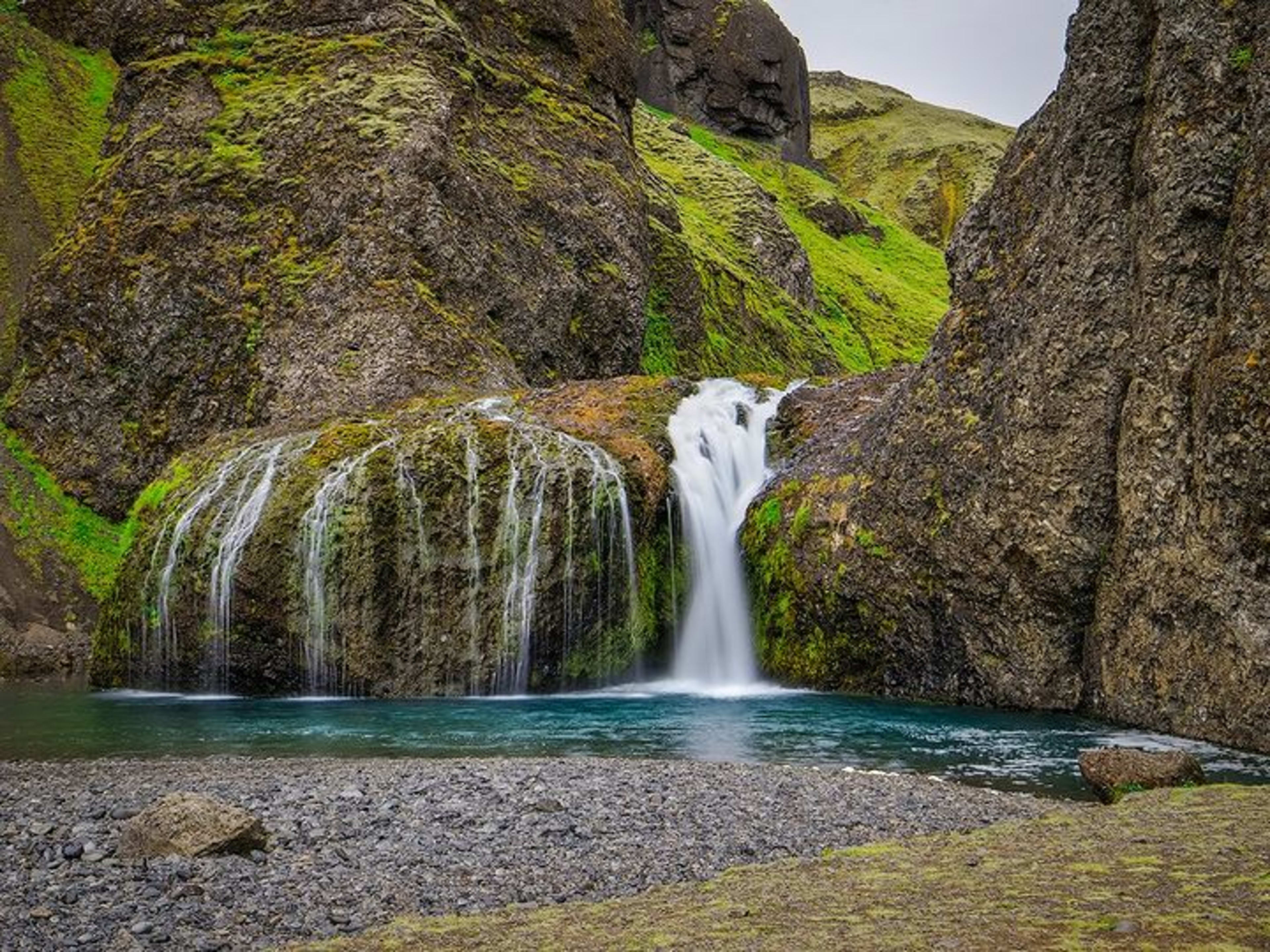
Location information: Approximately a 10-minute drive from Churchtown.
How to get there: If you are driving east from Ring Road 1, follow the route north towards Geirland, then exit onto Highway 203. From the exit along the way, cross the Skaftarhreppur Bridge to find Tjaldsvaedid Kleifar Campground. Convenient free parking is available at the campground. The parking lot is located across the street from the campground and the waterfall.
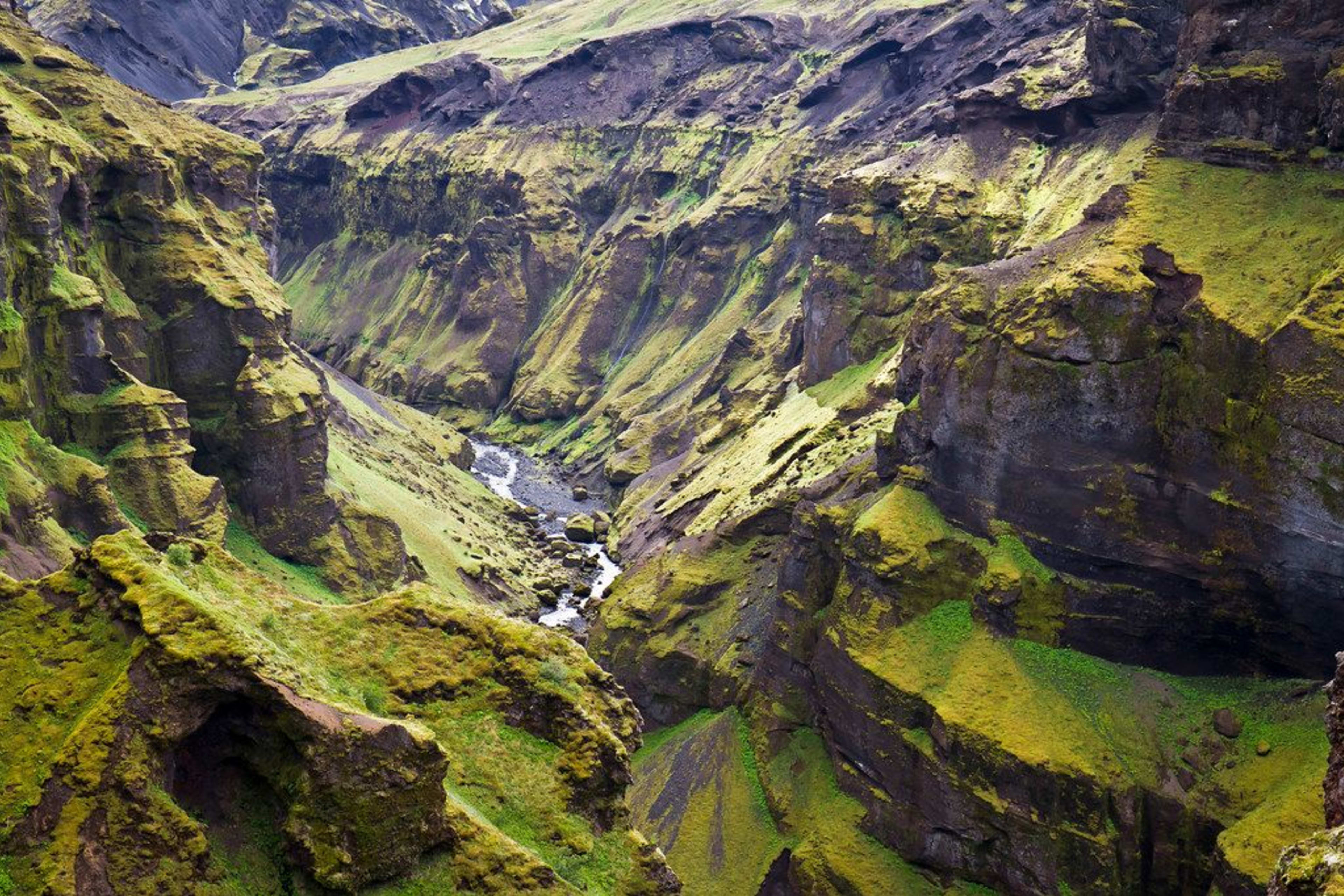
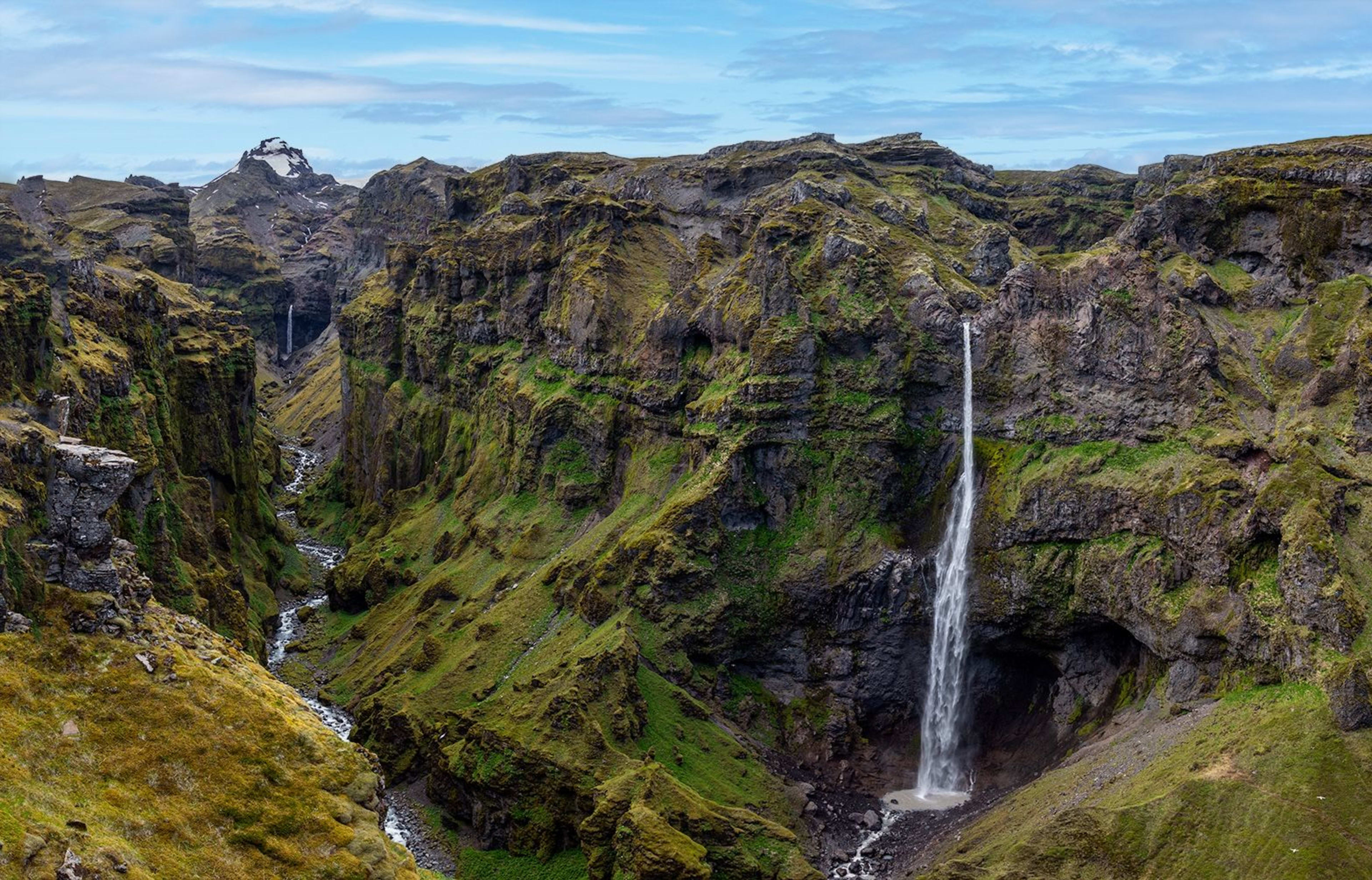
Feather Canyon (Fjaðrárgljúfur)
Reason for inclusion: As a popular filming location for movies, TV series, and music videos, Feather Canyon (Fjaðrárgljúfur) is a favorite among photographers. This canyon, about 100 meters deep and 2 kilometers long, is near the town of Kirkjubjarklaustur, far from the crowds, like a tranquil paradise. Lush green vegetation, steep cliffs, and stunning waterfalls adorn this picturesque landscape. Beneath the towering cliffs, a winding river flows through, moss-covered rocks, and occasional wildflowers dot the surface. You can start from the bottom of the canyon and follow the marked paths upwards, hiking to different viewpoints to explore the winding canyon from various angles and experience the raw yet exquisite beauty of Iceland.
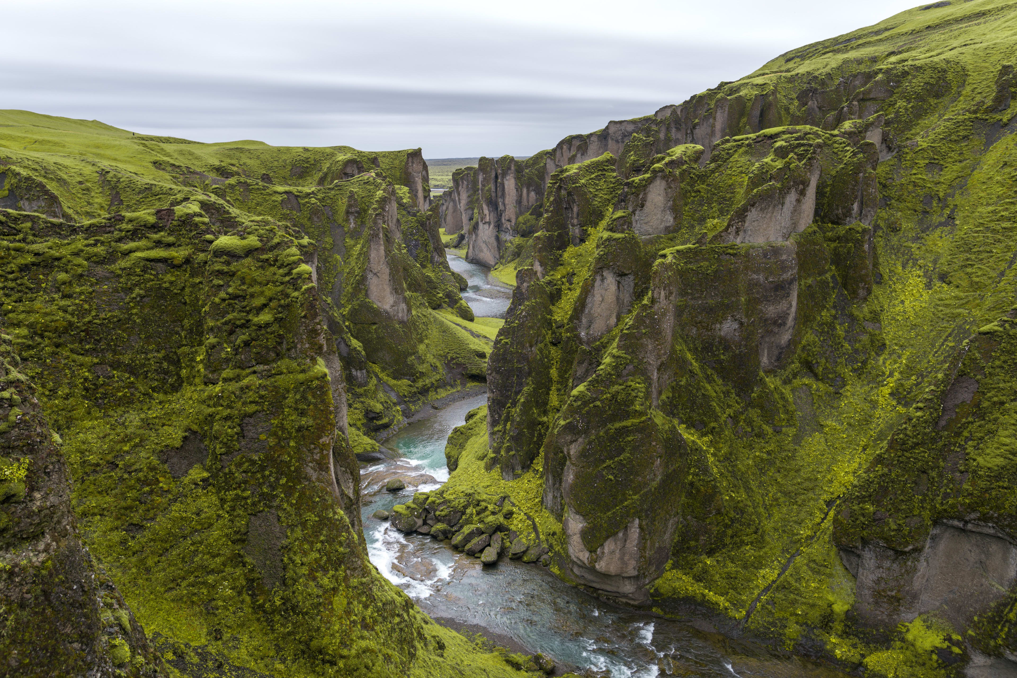
If you're driving in Iceland during the summer, this is an absolute must-see on the road from Vík to Vatnajökull National Park .
In winter, Feather Canyon is covered in a layer of silver, giving it a unique look, but it is generally not open to the public.
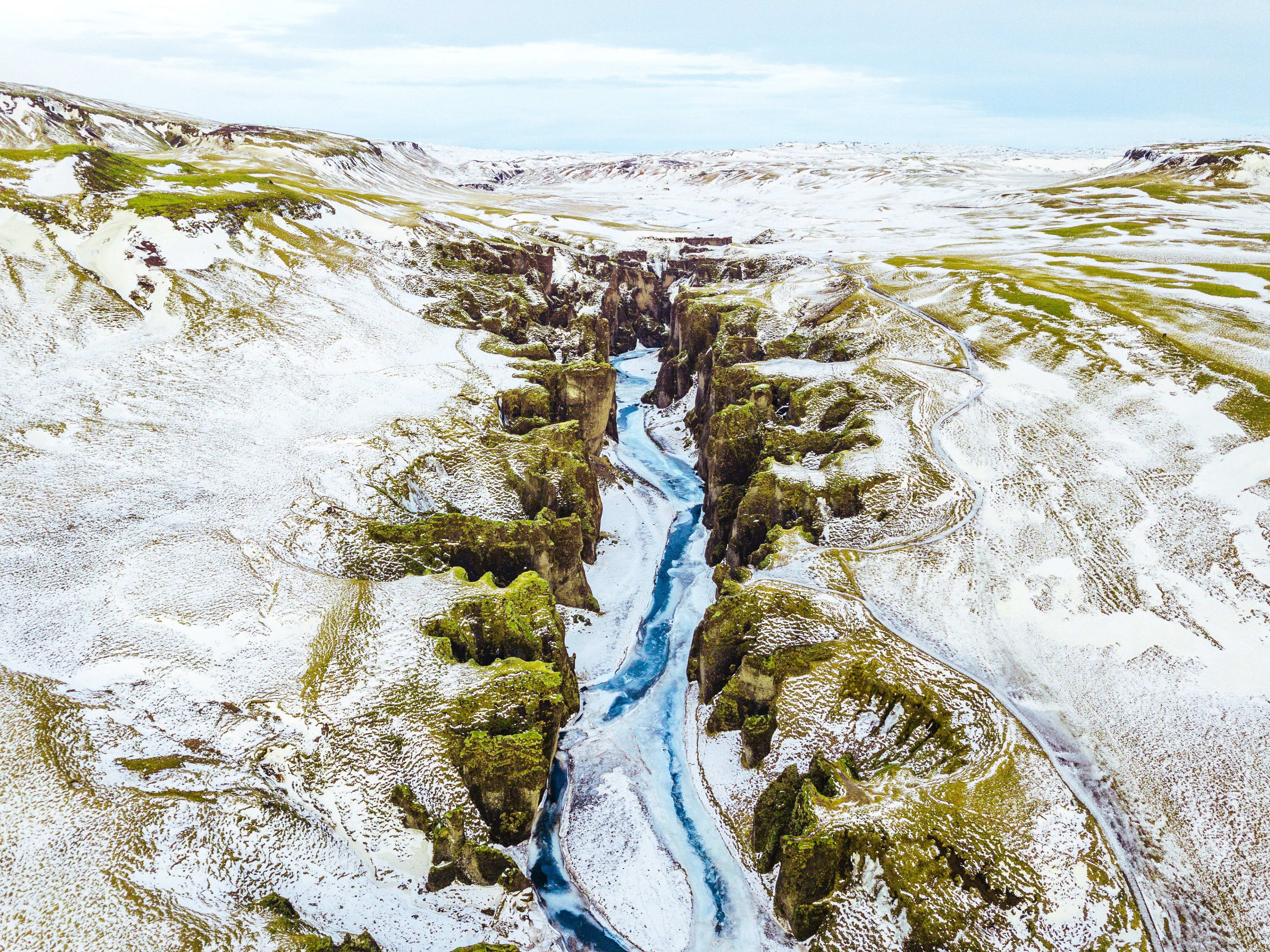
Location information: Approximately 300 kilometers from the capital Reykjavik, near the town of Church.
How to get there: Take Highway 1 on the Ring Road toward Skaftafell, turn left onto Highway 206 to reach the parking lot, and then walk to the canyon.
Important notes for visitors: Summer temperatures are more stable and there are longer hours of sunshine, making it a good time to visit. Winter is not recommended as roads may be closed due to slippery conditions.
Related itineraries: Two-day tour of Iceland's South Coast in summer , Three-day tour of Iceland
Steam Valley (Reykjadalur)
Reason for inclusion: Reykjadalur, a steam valley in southern Iceland, adjacent to the town of Hveragerði on Iceland's south coast, is most attractive for its naturally formed geothermal hot springs. Deep underground, geothermal waters mingle with glacial meltwater and pure rainwater, creating a winding natural hot spring river that flows quietly. Stepping into Reykjadalur is like entering a dreamlike world: the rising steam from the valley is as soft as a veil, enveloping you in a fairyland.
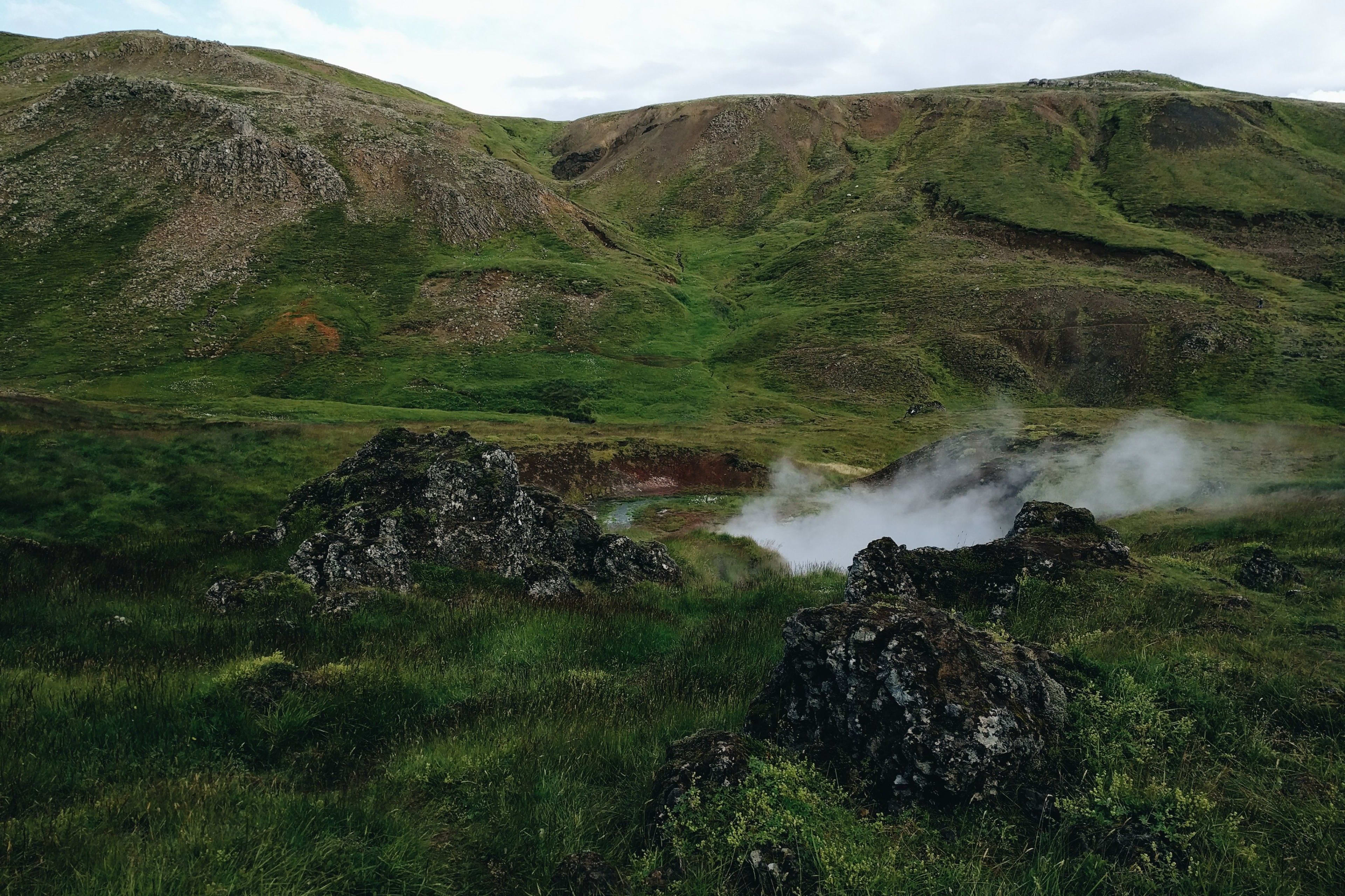
A faint scent of sulfur permeates the air, the most primal aroma of nature. Following the paths through the valley, you'll discover a series of hot spring pools, surrounded by natural rocks and vegetation, forming secluded bathing areas. The hot spring pools in the valley vary in color, from deep blue to emerald green, shimmering in the sunlight. Steam rises from the surface, like the breath of the earth. Here, you can take off your shoes and step into the warm hot springs, feeling the warm embrace from the depths of the earth. On both sides of the valley, another kind of vitality of nature blossoms: moss, wildflowers, and shrubs grow tenaciously in the volcanic soil, adding endless wild charm to this seemingly desolate region.
Location information: Adjacent to the town of Hjalairzy on Iceland's south coast
How to get there: From the capital Reykjavik, head south along Ring Road 1 for about an hour until you reach Hlaagerzi. In the town, take a gravel path to the parking lot, from where you can hike into the Steam Valley.
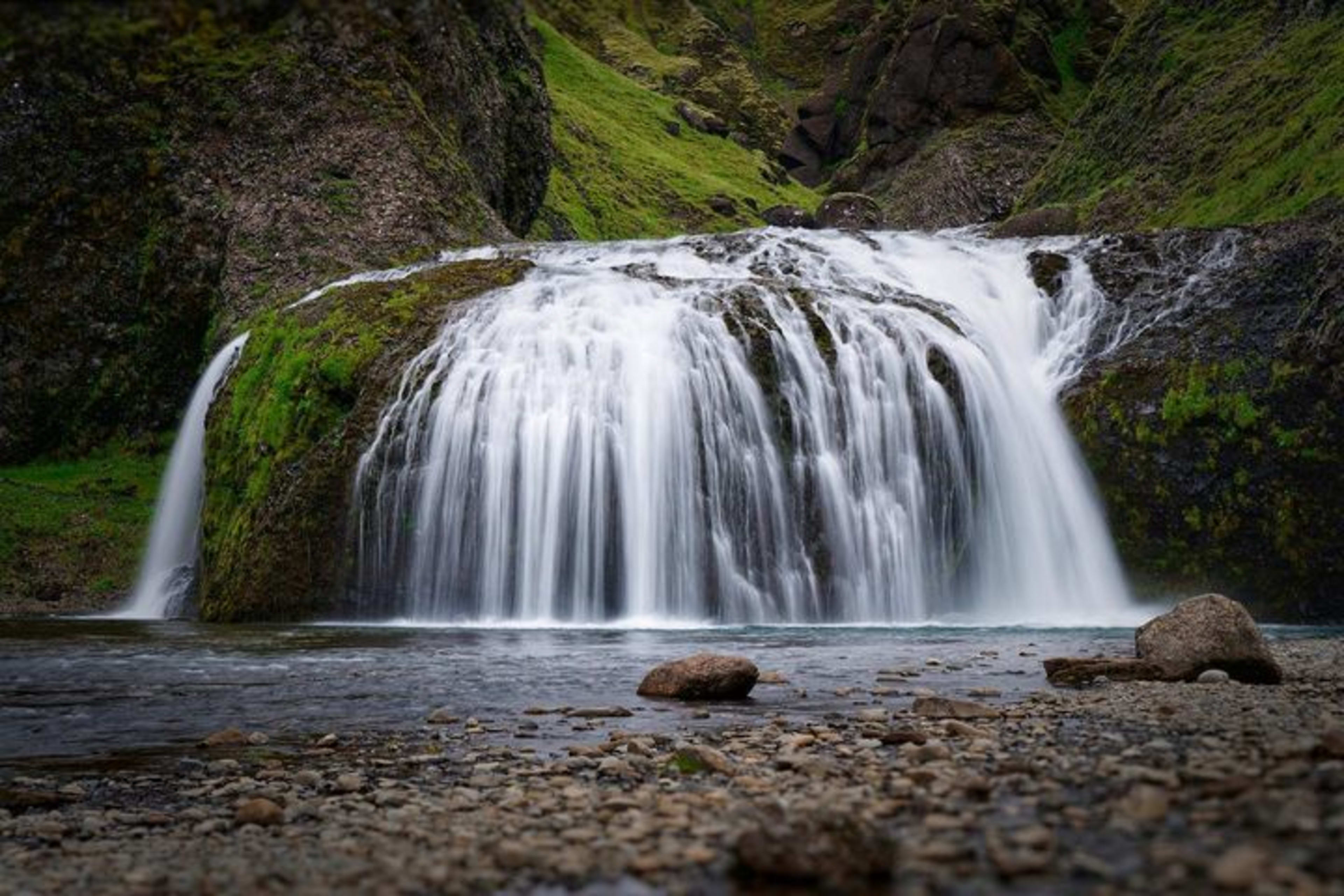
Secret Waterfall (Gljúfrabúi)
Reason for inclusion: If you search for information about Icelandic waterfalls on a search engine, you might not even find Gljúfrabúi on any list of Icelandic waterfall rankings , yet it is one of Iceland's most beautiful hidden waterfalls! The name Gljúfrabúi, meaning "dweller of the valley," is truly fitting. This waterfall is located in the narrow Hamragarðar cliffs next to Seljalandsfoss. When you arrive at the waterfall, the scene before you is breathtaking: the roaring river suddenly plunges into a tranquil pool, surrounded by moss-covered cliffs. Standing beneath the falls and looking up, the world seems to fall silent, leaving only the endless, awe-inspiring sound of the water resonating in your heart, an unforgettable experience.
Location information: In a narrow gorge near Seljalandsfoss waterfall, only one kilometer away.
How to get there: From Seljalandsfoss, you need to wade through a shallow river to reach the bottom of this 40-meter-high waterfall.
Important notes for visitors: When exploring the waterfall, please watch your step when crossing the river or climbing rocks to avoid falling. Hiking is only allowed if you are physically capable, and do not venture to the secret waterfall.
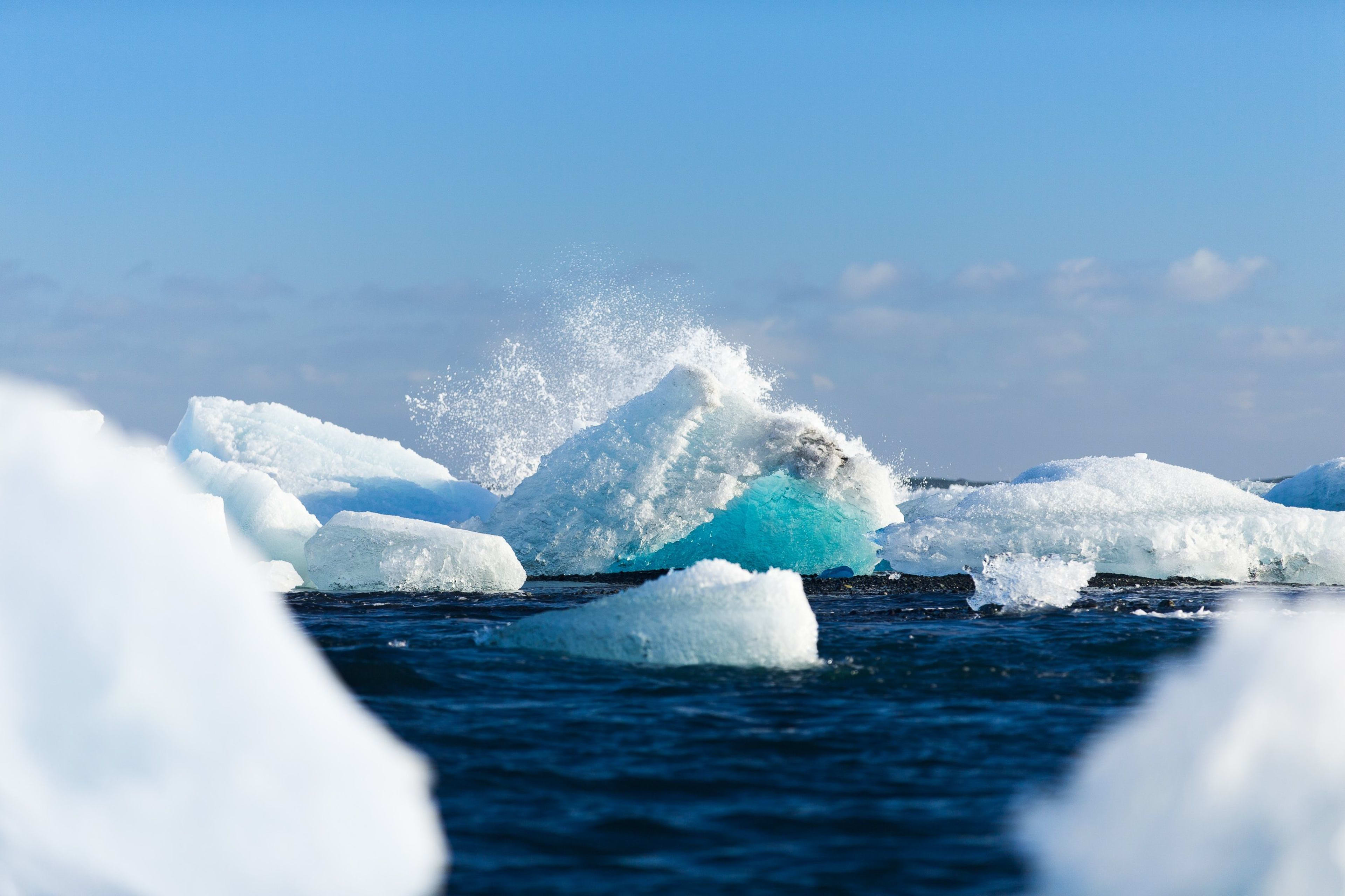
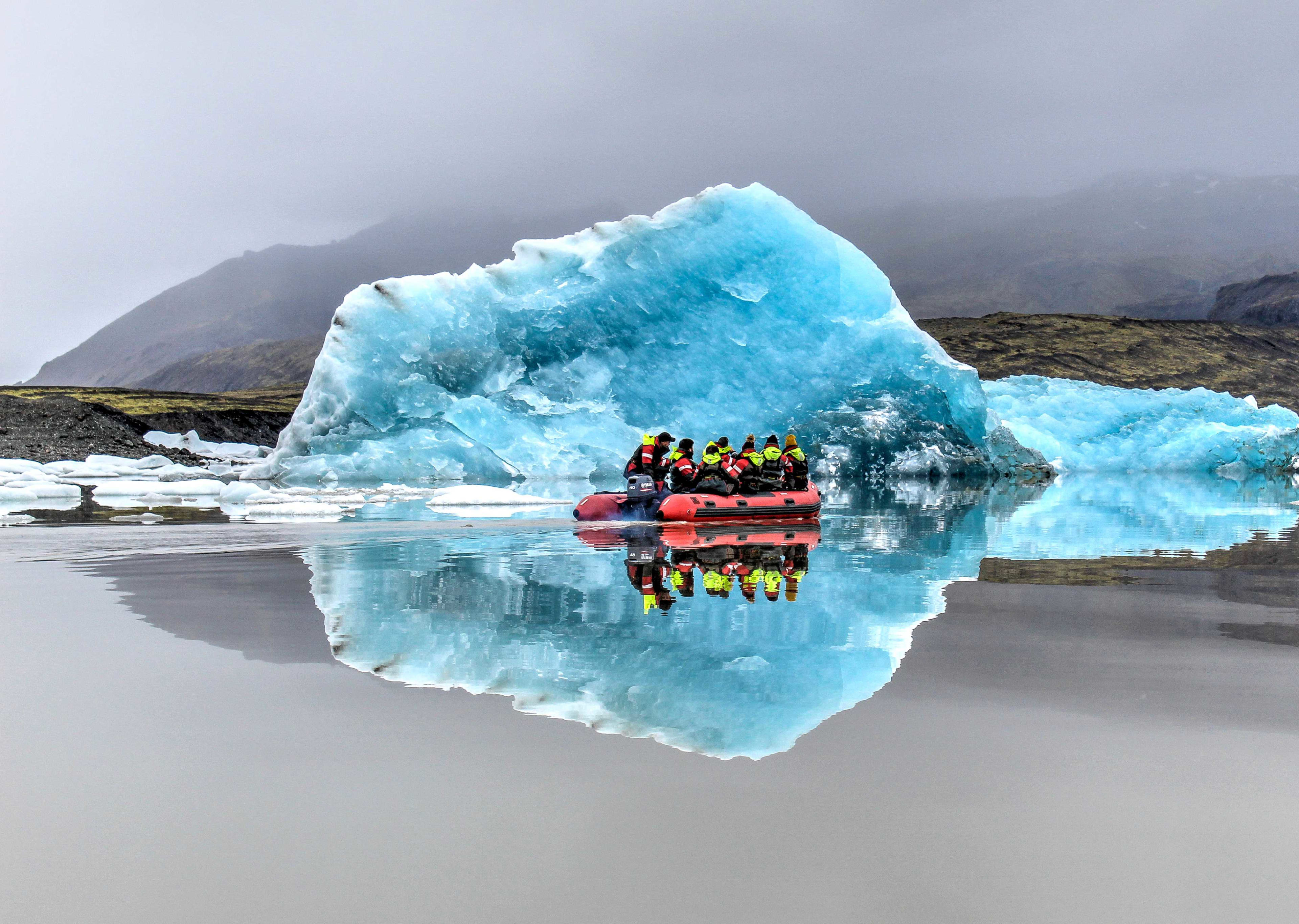
Small glacial lake (Fjallsárlón)
Reason for inclusion: Fjallsárlón, located in southeastern Iceland, is different from the more famous Jökulsárlón . Many people may ask, since they are both glacial lagoons, what makes Fjallsárlón stand out? The answer is that Fjallsárlón is more secluded and undisturbed, allowing you to truly immerse yourself in Iceland's pristine and unspoiled nature and experience the original impression of this "desolate country."
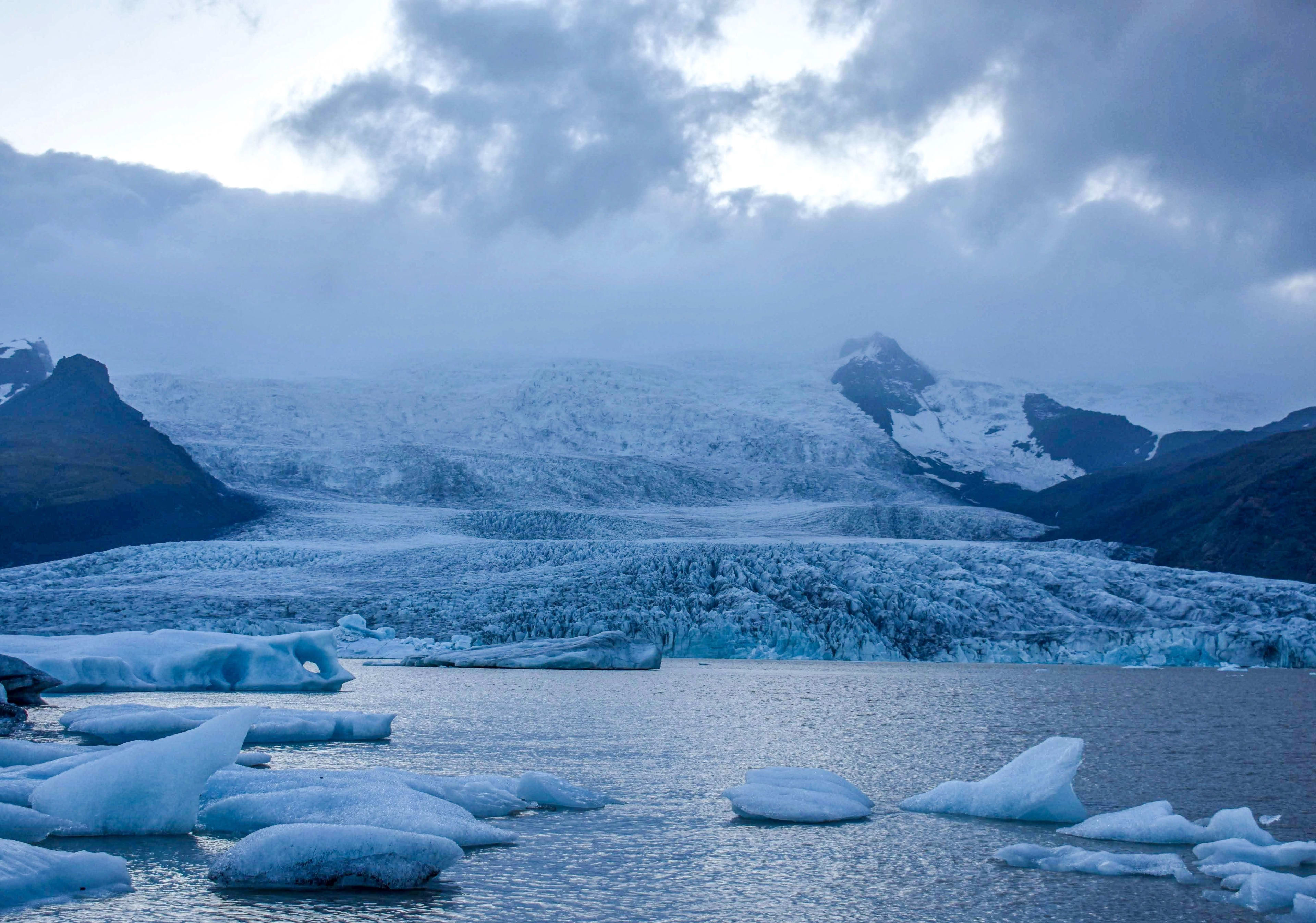
The Little Glacier Lagoon boasts crystal-clear waters, and its icebergs, each a masterpiece of nature, have broken off from nearby glaciers and drifted gently into the lake. They shimmer brilliantly in the sunlight, like countless diamonds scattered across the surface, making it not only a paradise for nature lovers but also a photographer's dream destination. Whether bathed in the first light of dawn or the setting sun, the icebergs display different colors and play of light and shadow. The towering mountains surrounding the lake further enhance its beauty and tranquility, making the Little Glacier Lagoon seem like a secret nature has carefully preserved for you.
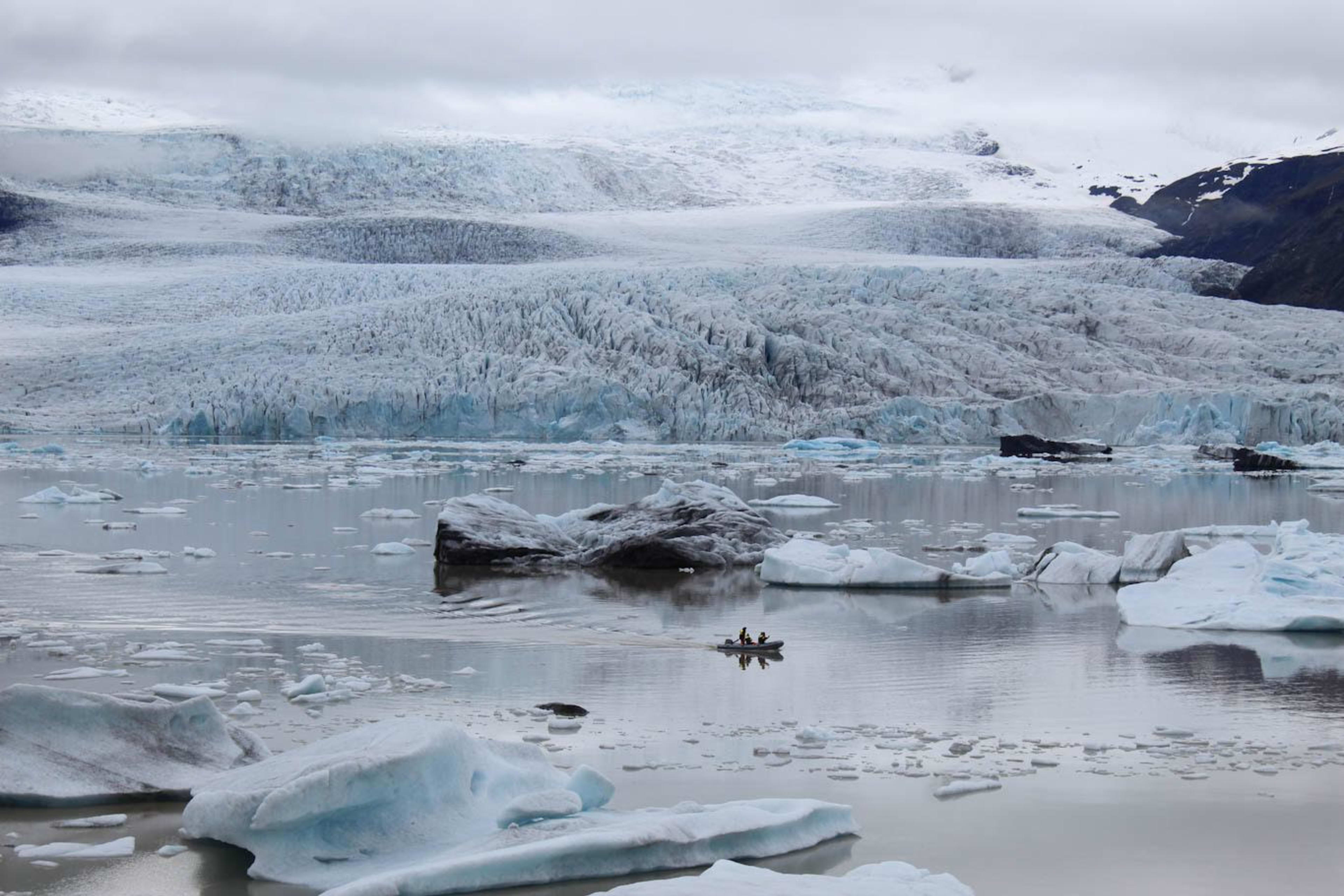
Here, you can also take a specially designed boat and, guided by a professional guide, navigate among these icebergs. As the boat moves, the icebergs gliding on the seemingly calm water collide with each other, producing crisp sounds that adorn this secluded place in southeastern Iceland.
Location information: At the foot of Vatnajökull Glacier in southeastern Iceland
How to get there: Follow Iceland's Ring Road (Route 1) east for 47 kilometers after passing through the Skaftafell Nature Reserve to reach the Little Glacier Lagoon.
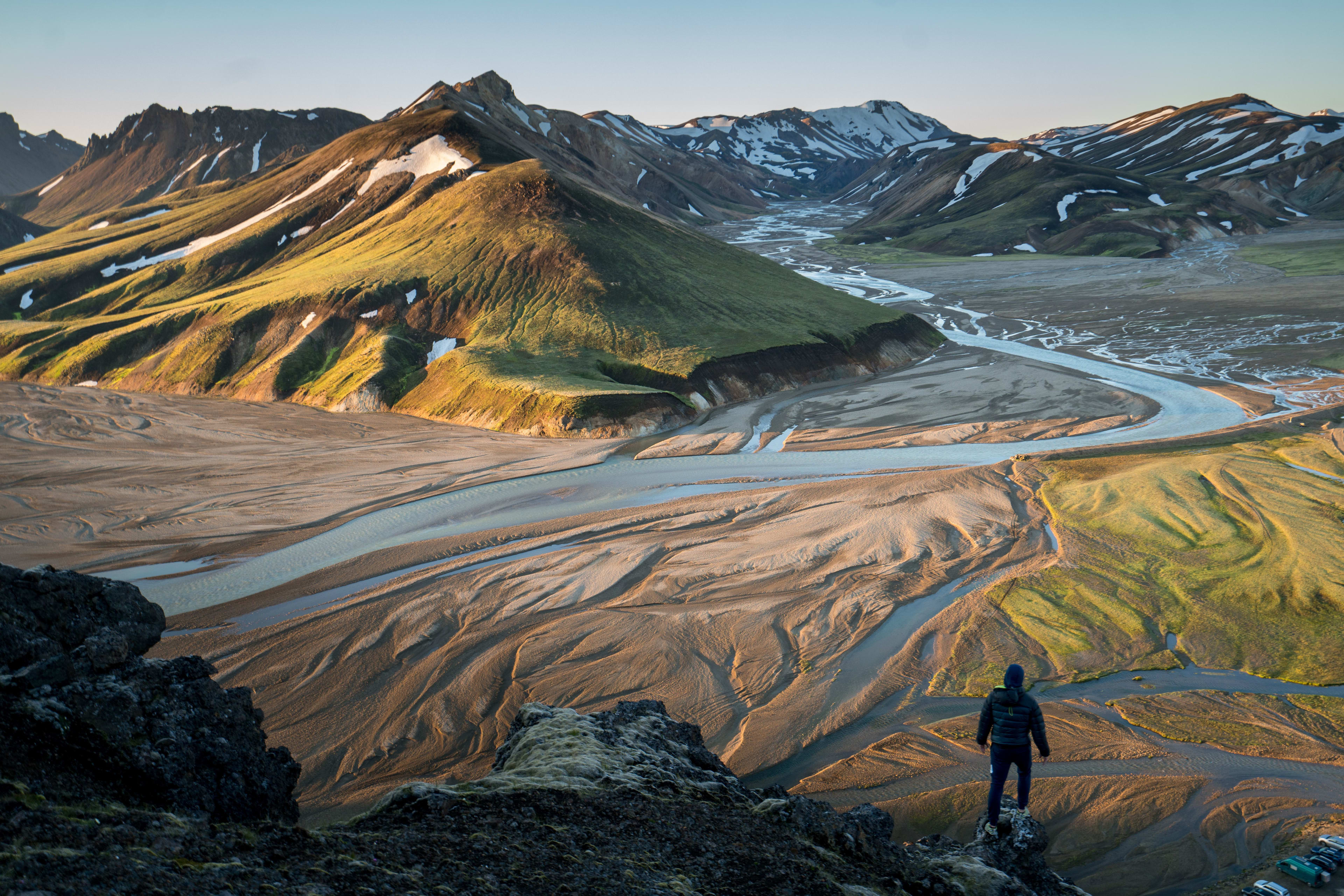
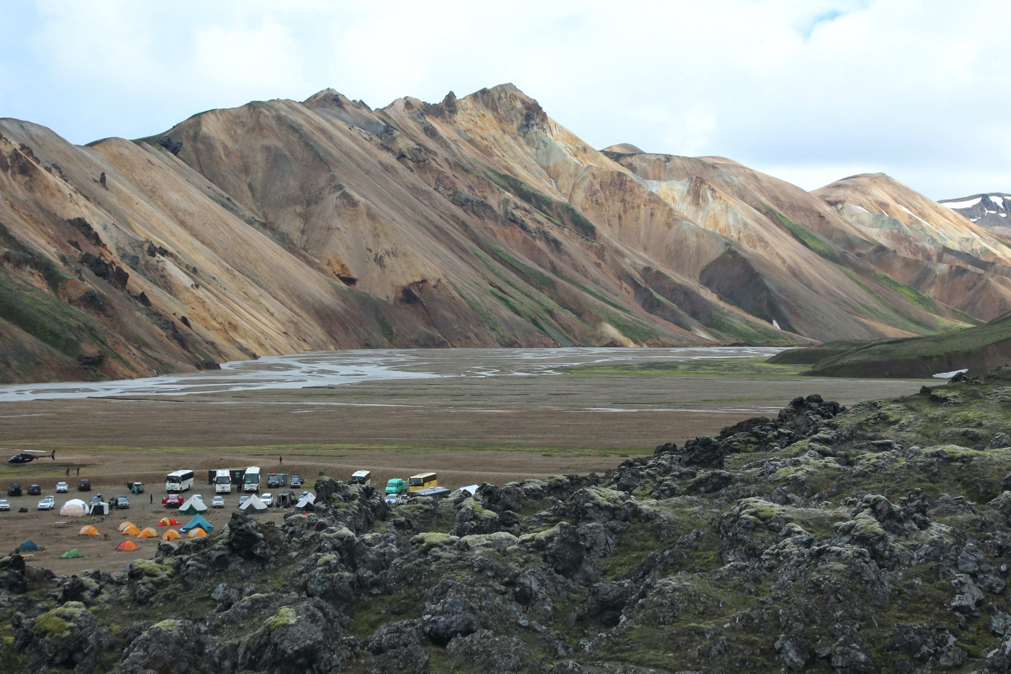
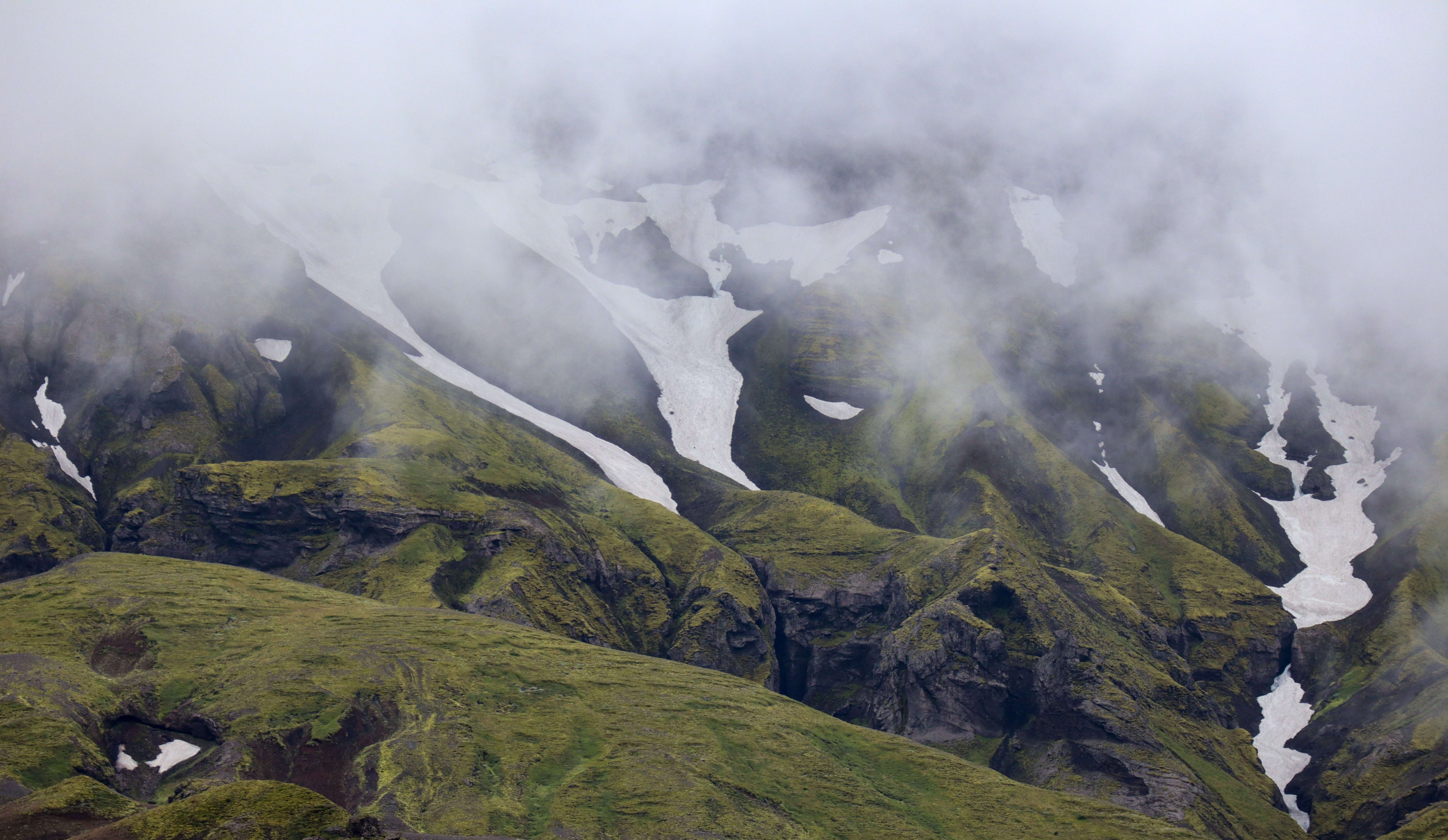
Landmannalaugar
Reason for inclusion: Located in the heart of southern Iceland, the Landmannalaugar highlands are vibrant with color and diverse landscapes. Shaped by volcanic activity and geothermal phenomena, a hike here unfolds a vivid panorama: the unique rhyolite formations, under the sunlight, display a multitude of colors ranging from deep blue to bright red, from golden yellow to dark green, like a palette of colors spilled by nature.
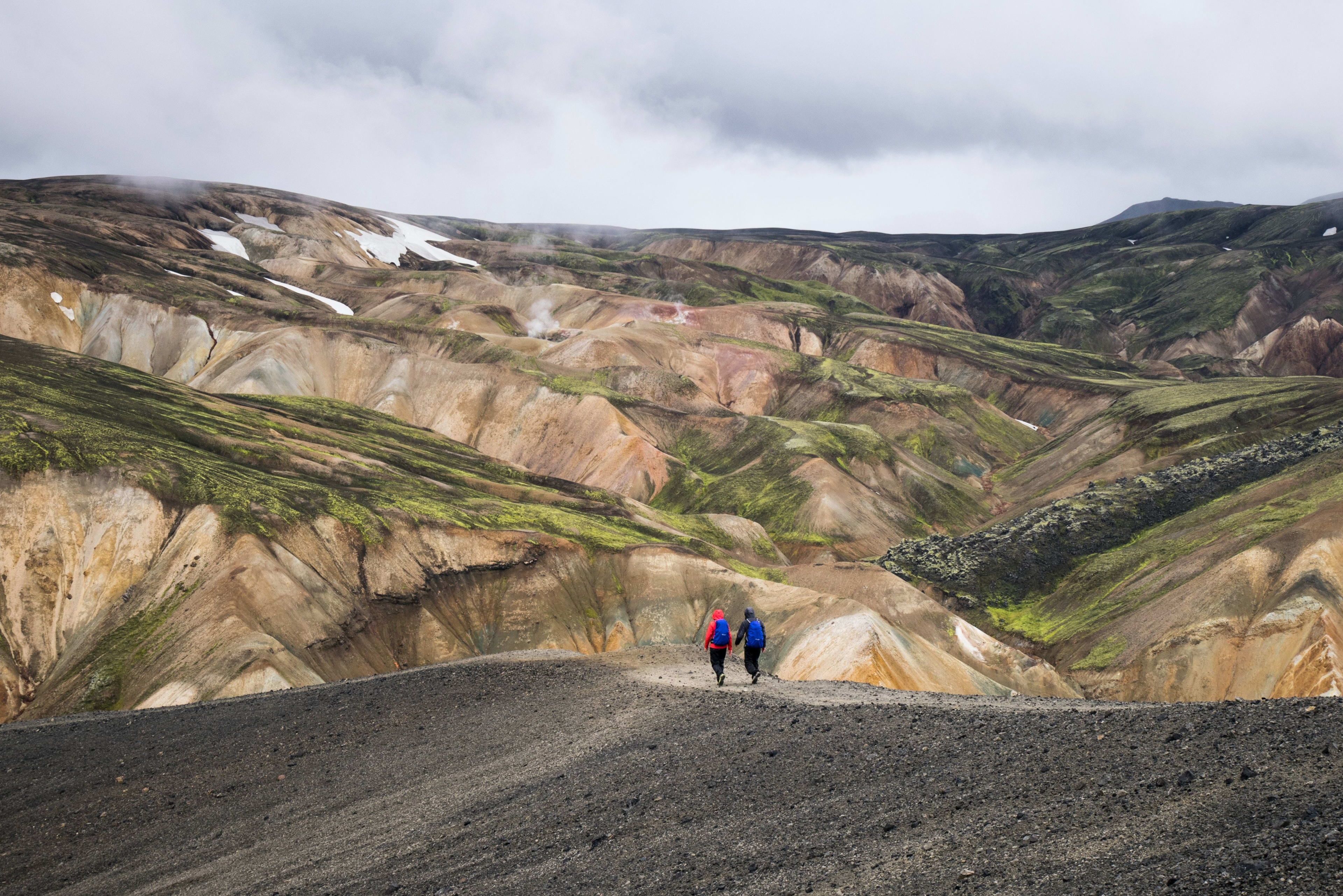
In this highland region, you'll also find a series of geothermal hot springs, scattered among the rugged terrain, steaming and bringing a touch of life to this desolate landscape. The vegetation around the hot springs is exceptionally lush due to the nourishment from the minerals, forming green oases that contrast sharply with the surrounding volcanic rocks and gravel.
Here, dreamlike hiking trails, natural hot springs, and colorful rhyolite mountains give every corner of Landmanalauca a story to tell, waiting to be explored. It's especially suitable for camping!
Location information: Inland highlands region in southern Iceland
How to get there:
1. From the town of Selfoss in western Iceland or Þingvellir National Park in the Golden Circle area .
2. The route along Iceland's south coast into the highlands is longer, but it offers the opportunity to visit Iceland's renowned natural attractions such as waterfalls, volcanoes, glaciers, and black sand beaches.
Important Notes: Open only during the summer months (June-August). Driving to Landmannalauka requires renting a 4WD vehicle. If you are driving to the Highlands, please note that due to recent policy changes by the Icelandic Environment Agency, you will need to reserve parking spaces in advance. Alternatively, you can join a tour group traveling in a Super Jeep.
Related Itinerary: Landmana Lauka Highlands Day Trip
Thorsmork (Thorsmork)
Reason for inclusion: For those who love wilderness adventure, Iceland is a mysterious land waiting to be discovered, a perfect destination to put on outdoor gear, delve into nature, and experience real adventure.
Besides Landmannalauka mentioned earlier, in southern Iceland lies another hidden gem known as Thor's Valley— Þórsmörk . The name Þórsmörk itself evokes a sense of mystery and power. Majestic peaks rise high, and the valley is filled with lush green vegetation, offering different views in each season. It's not only a paradise for hikers but also a haven for adventurers eager to explore the unknown and experience thrills.
Imagine traversing rugged mountain paths, squeezing through narrow gaps, and crossing babbling underground streams, finally finding yourself standing in a valley surrounded by three majestic glaciers: Eyjafjallajökull , Mýrdalsjökull, and Tindfjallajökull (yes, three!). The sense of accomplishment and awe is indescribable. You can venture into this mystical valley along two renowned hiking trails: Fimmvörðuháls and Laugavegur. (For more information on hiking trails in Iceland, see our other article: Hiking Trails for Beginners in Iceland)
Location information: Southern inland highlands of Iceland
How to get there: Enter the highlands from the mountain roads and gravel paths along Iceland's south coast.
Important Notes for Tourists: During the winter, routes to the Sosmok region are closed. If you plan to rent a car to drive to Sosmok, ensure you are renting a four-wheel drive vehicle capable of navigating the rugged inland highlands, and ideally, have some mountain driving experience. If you do not meet these requirements, joining a tour group is recommended for your safety.
Yoda Cave (Hjörleifshöfði)
Reason for inclusion: A must-visit for Star Wars fans. Star Wars fans, gather quickly and come visit Yoda Cave, a filming location in Iceland . Named after Hjörleifur, a famous settler in Icelandic history, and also known as Hjörleifur Cape, this cave is a monument to both natural and human history.
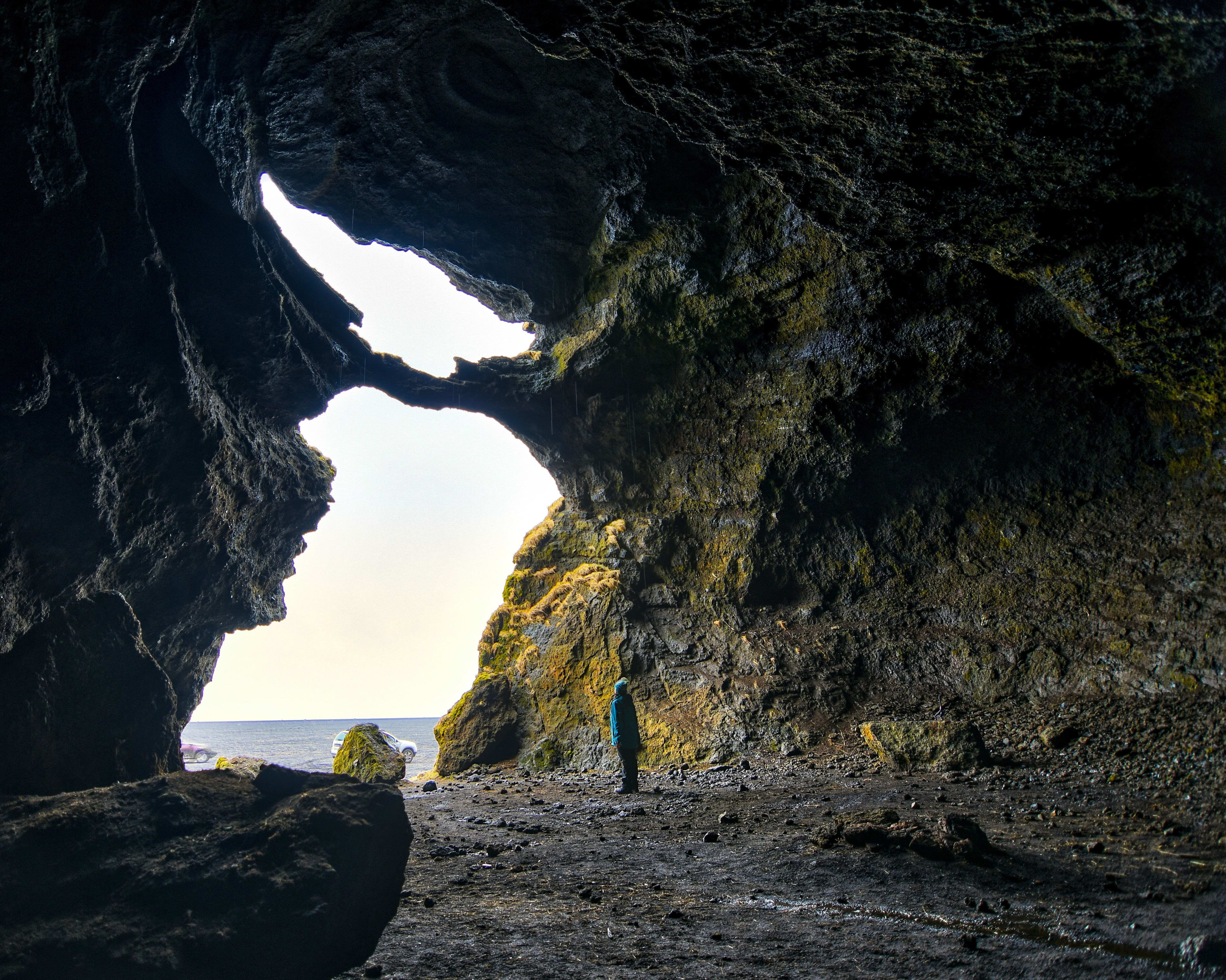
Formed by volcanic eruptions during the Ice Age, this uniquely shaped cave has two entrances, one above the other, with moss-covered rocks contrasting sharply with the dark volcanic stone. Since its appearance on the big screen in the film *Rogue One*, the cave has gained immense popularity, attracting countless visitors.
Location information: Mýrdalssandur, South Iceland
How to get there: It's about 202 km from Reykjavik or 15 km from Vik. It's easily accessible from Ring Road 1, on the right-hand side when coming from Reykjavik.
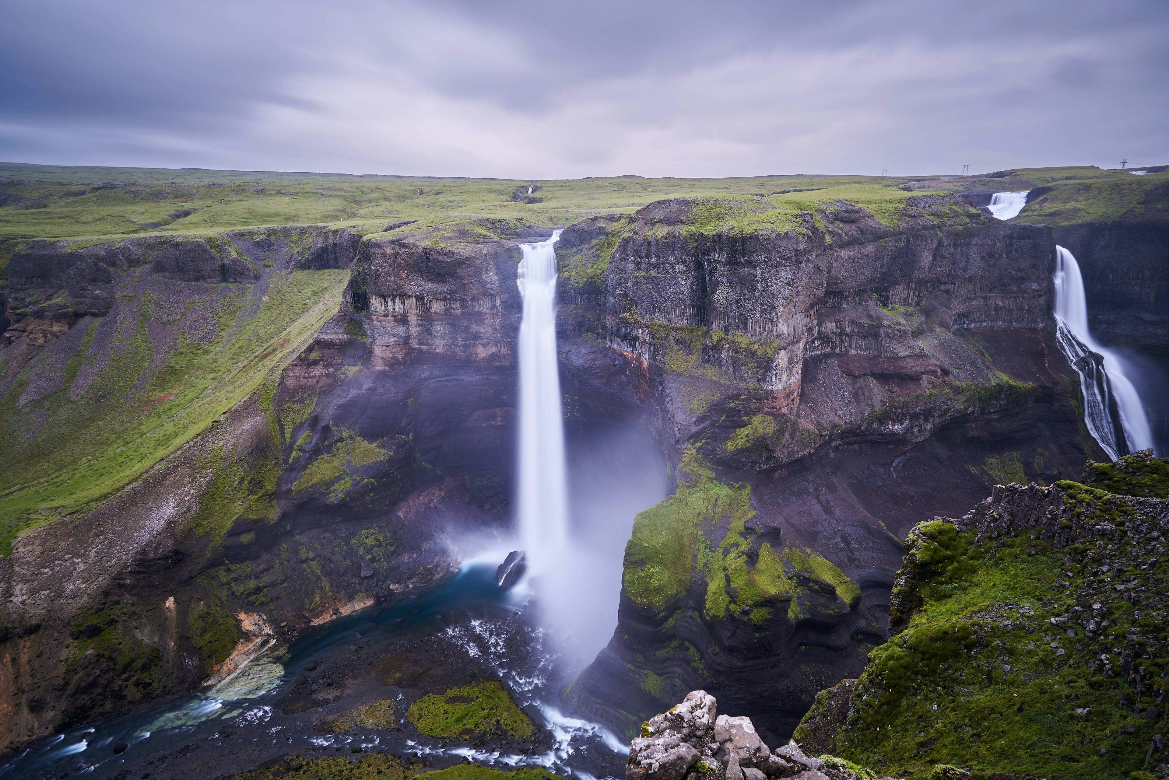
Múlagljúfur Canyon
Reason for inclusion: Múlagljúfur canyon, located in southeastern Iceland, is not widely known, but its beauty is undeniable. From above, it might appear as just a simple crack, but it's far from that. The canyon walls are etched with the marks of time, layers of rock recording Iceland's geological changes. These rocks display different colors under different angles and lighting, ranging from dark brown to rust red to bluish-gray, resembling a giant abstract painting.
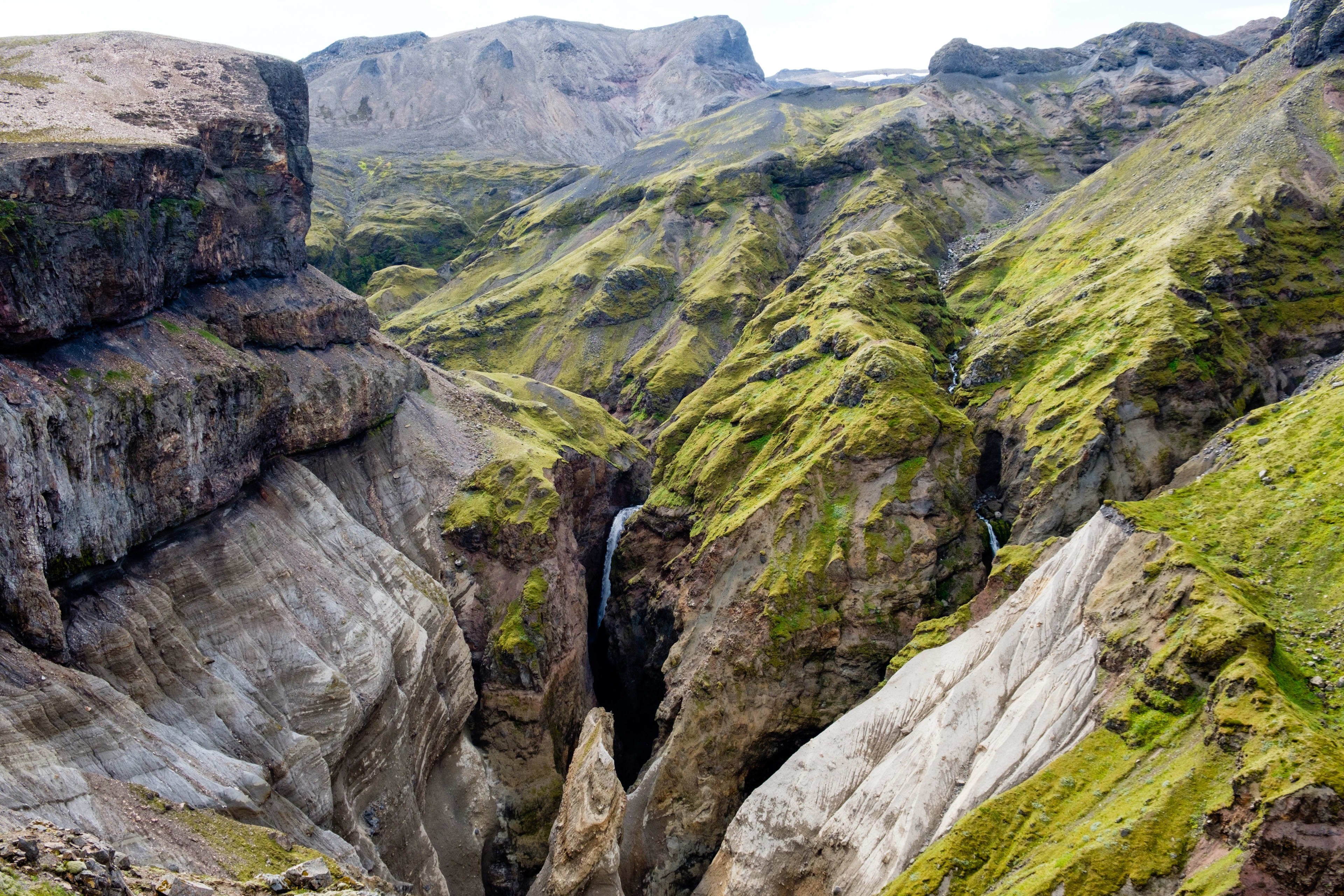
This southeastern hiking paradise is flanked by the spectacular Öræfajökull glacier , known as the "OK Glacier." The scenery is breathtaking, with cliffs covered in green moss and two majestic waterfalls cascading down to join the Múlaá River. At the bottom of the canyon, a winding river accelerates its flow through narrow passages, creating a babbling brook. In summer, sunlight filters through the canyon's crevices, illuminating the shimmering water. In winter, the canyon is blanketed in snow, the river transforming into a tranquil ice sheet, lending the entire canyon an air of profound mystery and seclusion.
Hiking here offers breathtaking views of the glaciers with every step, perfect for those seeking the thrill of exploring Iceland's unspoiled wilderness and tranquility. As you climb the path to the summit, part of the canyon unfolds before you. Turning around, you'll see panoramic views of the small glacial lagoon, Jökulsárlón glacial lagoon, and Diamond Beach. A visit here is like a profound dialogue with nature, bringing inner peace and tranquility.
Location information: Southern Iceland, adjacent to the Little Glacier Lagoon, not far from the famous Jökulsárlón Glacier Lagoon and Diamond Beach.
How to get there: The canyon is 231 miles (372 km) from Reykjavik. Visitors from the Icelandic capital must drive for approximately 4 hours and 30 minutes via the ring road to reach the canyon. While driving, pay attention to the map; as you approach Múlagljúfur, look for a small gravel road alongside the ring road. The canyon's parking lot is located next to this rough road. If you reach Jökulsárlón Glacier Lagoon and Diamond Beach, it means you've gone too far and must turn back.
Haifoss Waterfall
Reason for inclusion: For travelers seeking to escape the crowds and explore Iceland's lesser-known waterfalls, Háifoss's grandeur, beauty, and secluded solitude make it an unforgettable highlight of any Icelandic trip. Háifoss, literally meaning "High Waterfall," truly lives up to its name; at 122 meters high, it is one of Iceland's tallest waterfalls, with water cascading down a cliff into the gorge below, creating a powerful and unforgettable roar.
The waterfalls are formed by the Fossá River, which splits into two tributaries as it flows through the Þjórsárdalur valley, creating the Háifoss and the adjacent Granni waterfalls. These two waterfalls are often mentioned together and are sometimes referred to as the "Twin Waterfalls" or the "Twin Heroes Waterfalls." During your visit, be sure to take some time to appreciate the captivating colors of the surrounding valley!
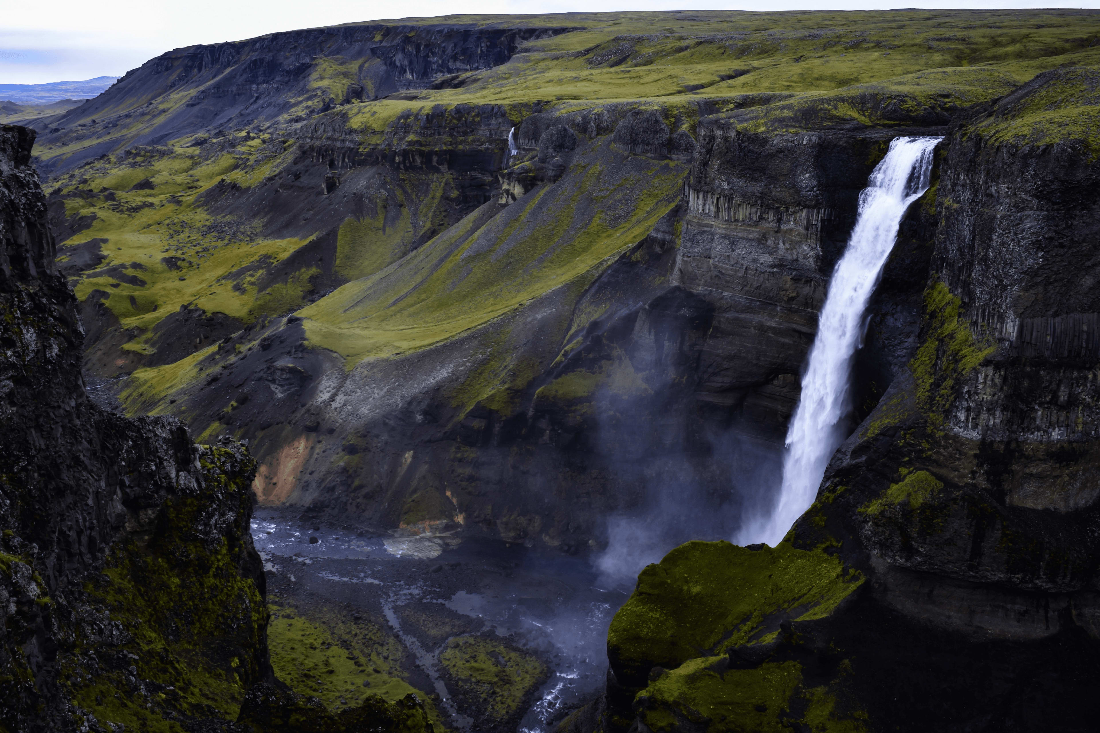
Location information: In the Þjórsárdalur valley in southern Iceland.
How to get there: Although the falls are not far from the Golden Circle and the capital Reykjavik , they are located deep in a valley. Getting there usually requires driving a 4WD vehicle along a gravel road to a parking lot near the falls, and then walking a short distance to reach the viewpoint.
Important Notes for Visitors: The roads to Haifoss are gravel roads and can be quite rough at times, so please be prepared for a challenging drive. In winter, the roads to the waterfalls may be closed due to snow accumulation, so be sure to check the latest road conditions and weather forecasts before planning your visit.
Iceland's south coast boasts breathtaking scenery, and the best way to experience these lesser-known spots is by car. Consider our self-drive packages, with various durations to choose from: 4-day summer self-drive tour of Iceland's south coast , 5-day/4-night simplified summer self-drive tour of Iceland , and 6-day curated summer self-drive tour of Iceland .
Eastern and Northern Iceland
Hengifoss Waterfall
Reason for inclusion: Although Iceland has many waterfalls, Hengifoss, located in northeastern Iceland, is unique in that its rock formations are composed of red clay and basalt formed by volcanic eruptions during the Tertiary period, 5-6 million years ago. On the rock walls of the waterfall, you can observe sediments and old soil formed by the oxidation of iron in the clay, which form red stripes that are very eye-catching and even reminiscent of a lava chocolate cake!
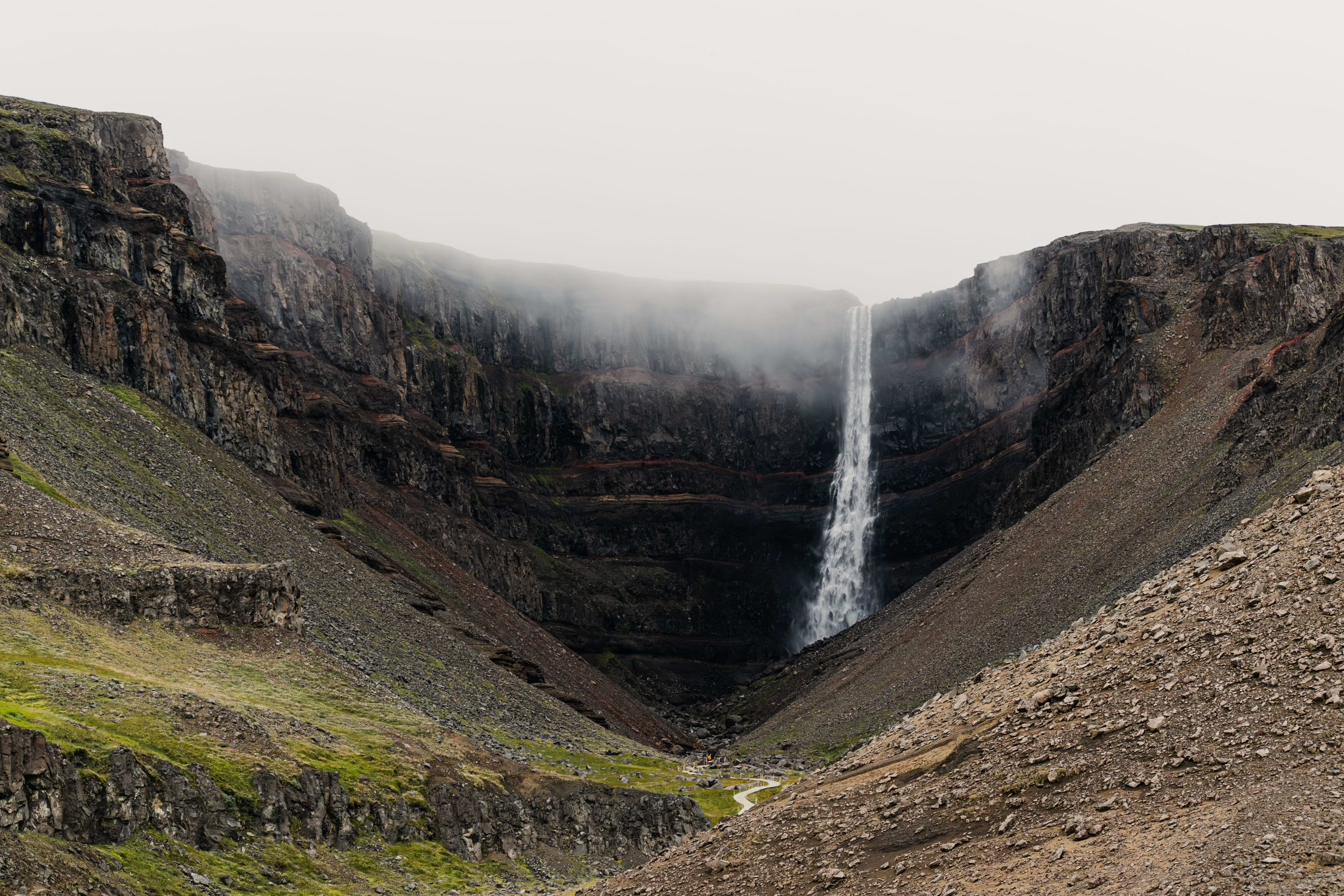
The dark basalt layers interspersed with rings of red clay resemble strawberry powder sprinkled by nature, enticing visitors to explore further. Moreover, it's worth noting that this waterfall, at 128 meters high, is the third highest in Iceland, making it truly breathtaking.
Location information: Fljótsdalshreppur region in eastern Iceland
How to get there: From Egilsstaðir , the largest town in eastern Iceland located along Route 1 , there are two routes to Hönjót Waterfall. You can drive about 35 kilometers from either the west or east side of Lagarfljot. If you choose the west route, some sections will be gravel. On the hill near the wooden bridge close to Egilsstaðir Airport, you'll find the junction with Route 1. The road sign is Route 931, pointing to Fljótsdalur and Skriðuklaustur. There is also a hiking trail from the road to Hönjót Waterfall, which most people choose to hike; just walk to the base of the falls for some great photos!
Important notes for visitors: The best time to visit Henggi Falls is during the summer months, June and July, when the river is usually full, making the falls even more spectacular. Also, the falls and the canyon face southeast, so if you want to see the sunlight shining on the falls, try to go in the morning.
In addition, there are two other places worth visiting near Hønjökull Waterfall. One is the Snæfellsstofa Visitor Center. During your trip, you can stop here to learn about Icelandic history and ancient medieval ruins, and see what local animals are found. The other great place is the Skriðklaustur Historical and Cultural Center, formerly the private residence of Nobel Prize nominee Gunnar Gunnarsson, now donated to the state. It hosts various events and exhibitions and is within walking distance.
When you're tired from exploring the Eastfjords, why not head to Vök Baths, Iceland's unique, odorless hot springs , to enjoy the stunning scenery and find peace of mind?
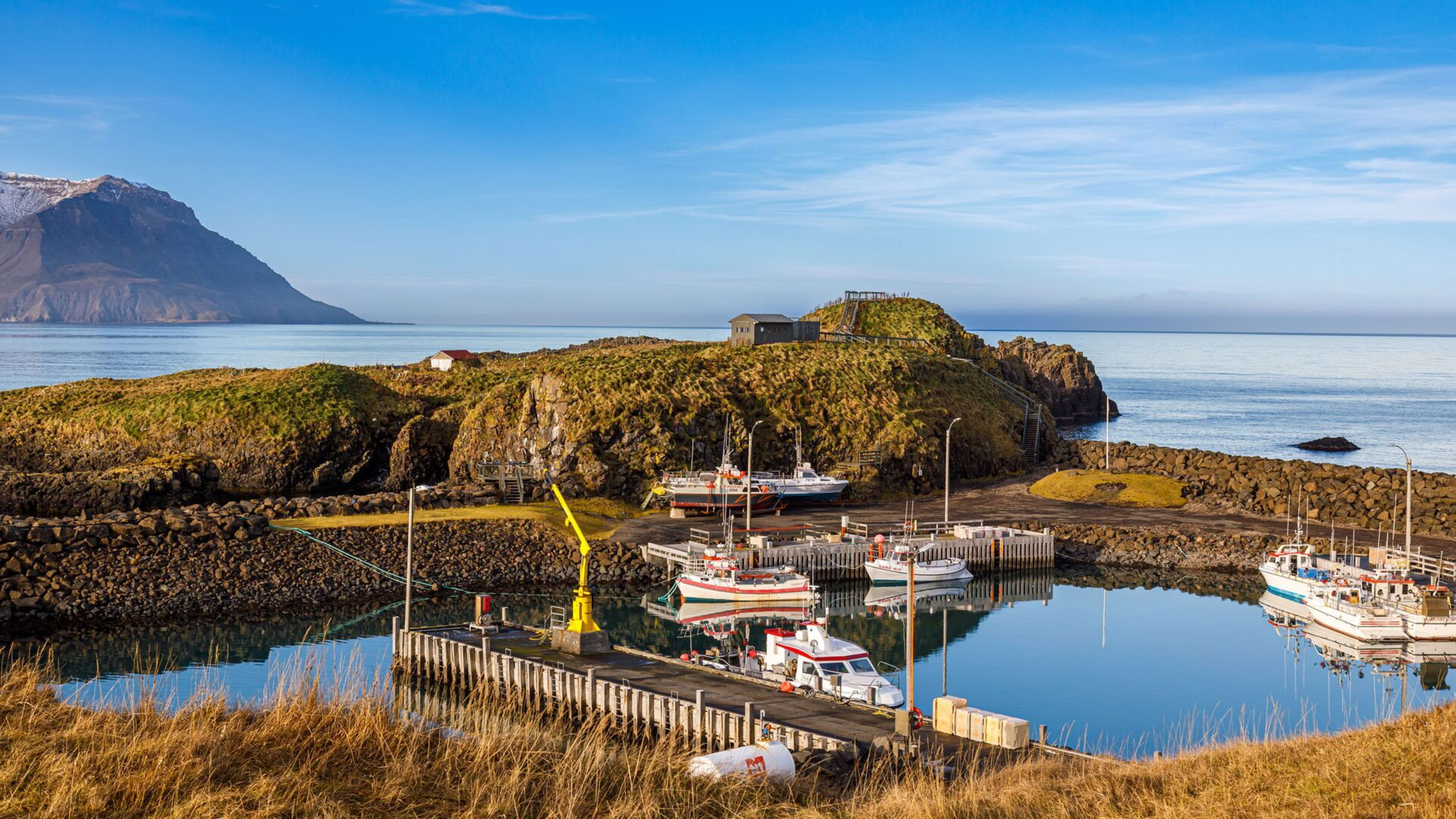
Djúpivogur
Reason for inclusion: Djúpivogur, also known as the town of Deep Bay, is home to dozens of giant eggs embedded in concrete slabs, stretching along the town's coastline as you drive through its streets, creating a unique landscape known as the "Eggs of Happy Bay." These giant eggs, meticulously crafted by local artist Sigurður Guðmundsson, each represent a native Icelandic bird species, totaling 34 eggs and symbolizing the rich birdlife of the region. These granite eggs are not only a tribute to Iceland's natural ecology but have also become the town's most iconic artistic landmark.
Of course, Dúpiógul's charm extends far beyond this. Besides its modern art embellishments, the town boasts a rich historical heritage. Since 1589, it has been an important trading center in Iceland. The town's oldest building, Langabúð, built in 1790, has been transformed into a cultural center, showcasing the town's history and culture to visitors. Meanwhile, the Búlandsnes Nature Reserve is a paradise for birdwatchers due to its abundant birdlife.
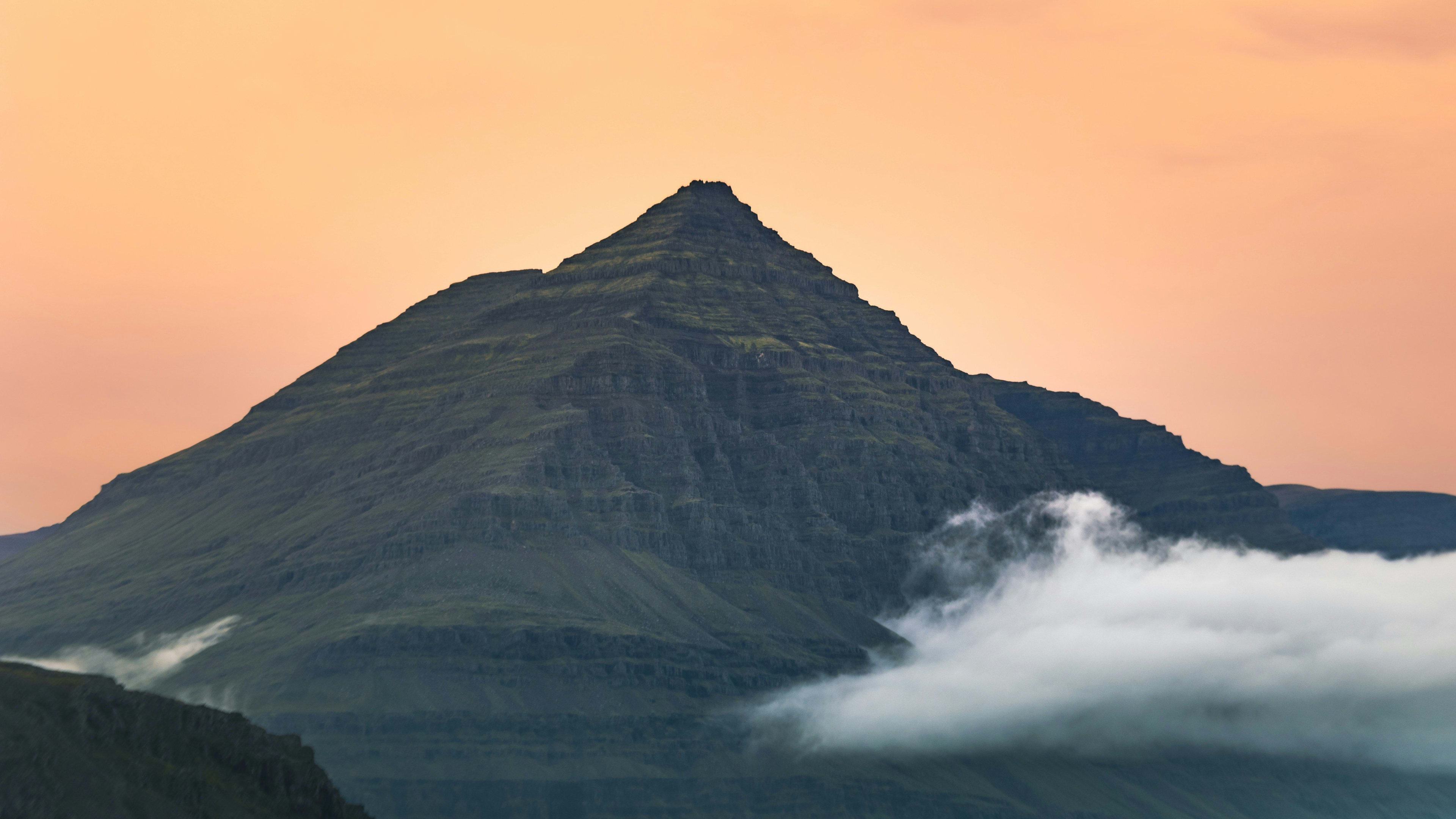
Another noteworthy attraction is Búlandstindur, a pyramid-shaped mountain whose unique shape and mysterious legends attract countless visitors. Standing at 1069 meters, it is said to possess magical powers, helping people fulfill their wishes. Here, you can not only witness locals making wishes, but you might also be drawn in by this mystical power, tempted to try it yourself and see if your prayers come true.
Location information: Hamarsfjörður fjord on the coast of the Búlandsnes peninsula in eastern Iceland.
How to get there: Drive 3 hours east from Höfn or about 1 hour south from Brezdasvik, and you will find Pivogur while driving on Route 1.
Lake Lagarfljót
Reason for inclusion: Lake Lagarfljót is hidden in the eastern fjord region of Iceland, located in Eijlstadí, the largest town in eastern Iceland. Formed during the Ice Age, it is a huge basin left by glacial erosion of the surrounding valleys, later filled with meltwater. The lake is fed by several rivers and glacial streams, and the glacial silt suspended in the water gives it a unique color, constantly changing from deep blue to turquoise, adding a unique, mysterious, and tranquil atmosphere. However, although it is 112 meters deep, it is only 2.5 kilometers wide, meaning that it is sometimes mistaken by passing travelers for a river.
However, that might not be the main point. Perhaps the most important reason people come to this lake is to see if they can encounter the Loch Ness Monster. Legend has it that sightings of a snake-like monster (Lagarfljótsormurinn) swimming in the lake date back to the 14th century. This monster is said to be enormous, resembling both a snake and a worm, living deep in the unfathomable lake, and its whereabouts are elusive. Despite numerous eyewitness accounts, there is still no conclusive evidence to prove the existence of this monster, but these stories continue to attract countless tourists to explore it, and this monster is affectionately known as the Loch Ness Monster's cousin.
The natural environment surrounding Lake Lagard is equally captivating. Hallormsstaðaskógur, Iceland's largest forest, lies on its shores, making it a paradise for birdwatchers. Many also enjoy fishing or picnicking along its banks. If you're planning a trip along Iceland's ring road, consider stopping to immerse yourself in the folklore and unique landscapes surrounding the lake.
Location information: Near Eyirstadt, the largest town in eastern Iceland
How to get there: Drive to Eilstazy, then head to Lake Lagard.
Stuðlagil Canyon
Reason for inclusion: When you think of Iceland's basalt columnar jointing, what landmarks come to mind first? Is it the majestic Hallgrímskirkja Cathedral , or the black basalt columns standing beside Reynisfjara's black sand beach on Iceland's south coast ? Now, Iceland has another newly popular spot: Stuðlagil Basalt Canyon . This exquisite natural treasure, with its towering basalt columns forming a cathedral-like fortress, is further enhanced by the vibrant blue-green glacial river flowing through the canyon, adding to its mystique.
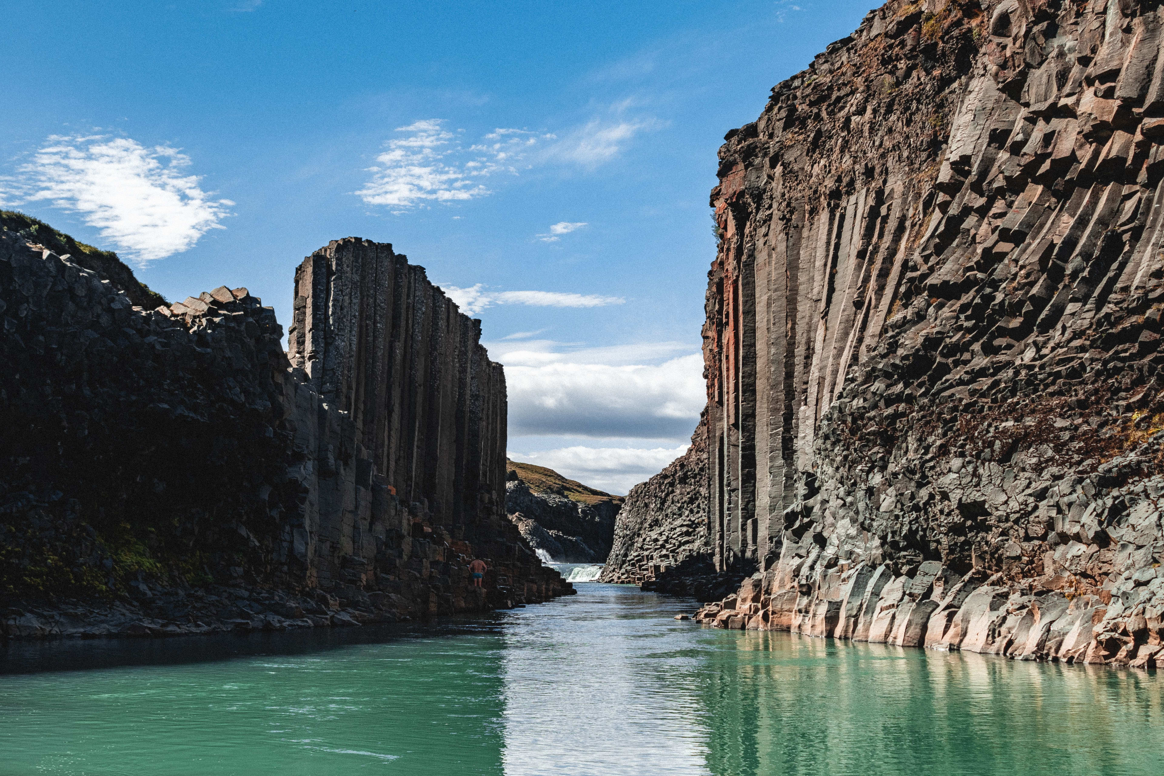
Previously, powerful glacial rivers flowed through the picturesque Jökuldalur valley, burying this stunning basalt canyon for many years—the water level was too high to cross. However, after the construction of the Kárahnjúkavirkjun hydroelectric power station, part of the river flowing from the highlands into the valley was diverted, revealing the canyon.
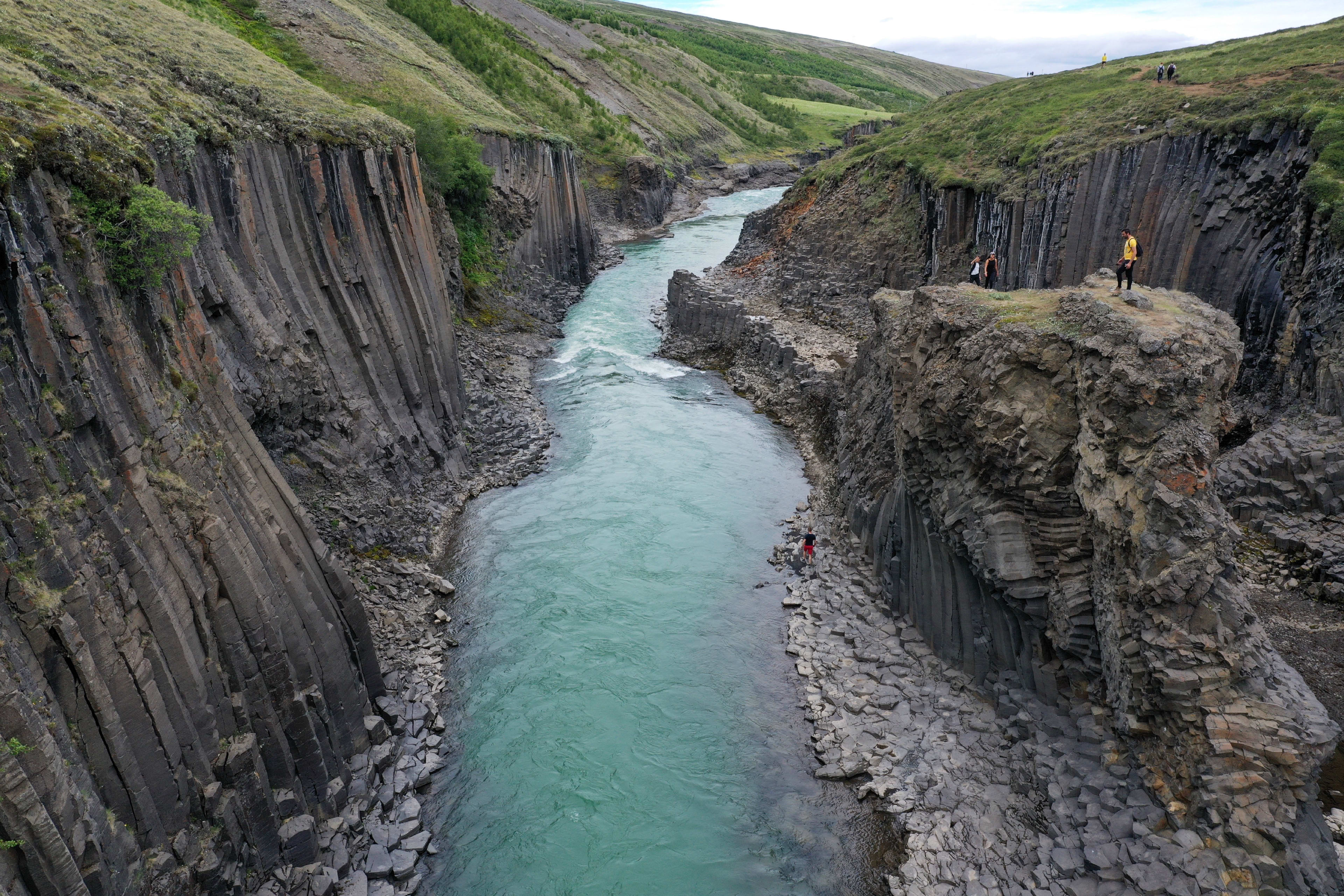
When you hike through the Stuðlagil canyon and witness for the first time this canyon formed by basalt columns, you can't help but be amazed by the wonders of nature: these huge rock pillars on the canyon walls seem to have been meticulously sculpted by an invisible sculptor, standing on both sides of the winding river, creating a unique and otherworldly atmosphere. You can't help but be captivated by the tranquility of the river flowing between the cliffs and the azure water, feeling as if you have stepped into an epic fantasy novel.
Location information: Jökuldalur Valley, East Iceland
How to get there: From Eilstazy, take Highway 923. The view of this secluded wonder begins near a bridge at Klautursel Farm. There are two parking lots, but only the eastern one provides access to the canyon; the western one offers access to a viewing platform.
Important Notes for Visitors: It's important to note that the water in the Stuðlagil canyon isn't always turquoise. The color of the river changes with the seasons. In summer, the river displays a mesmerizing turquoise hue, creating a vibrant natural scene against the backdrop of basalt columns. In spring, as the snow melts, the river turns a greyish-brown, offering a completely different natural landscape. However, summer is highly recommended for the best views!
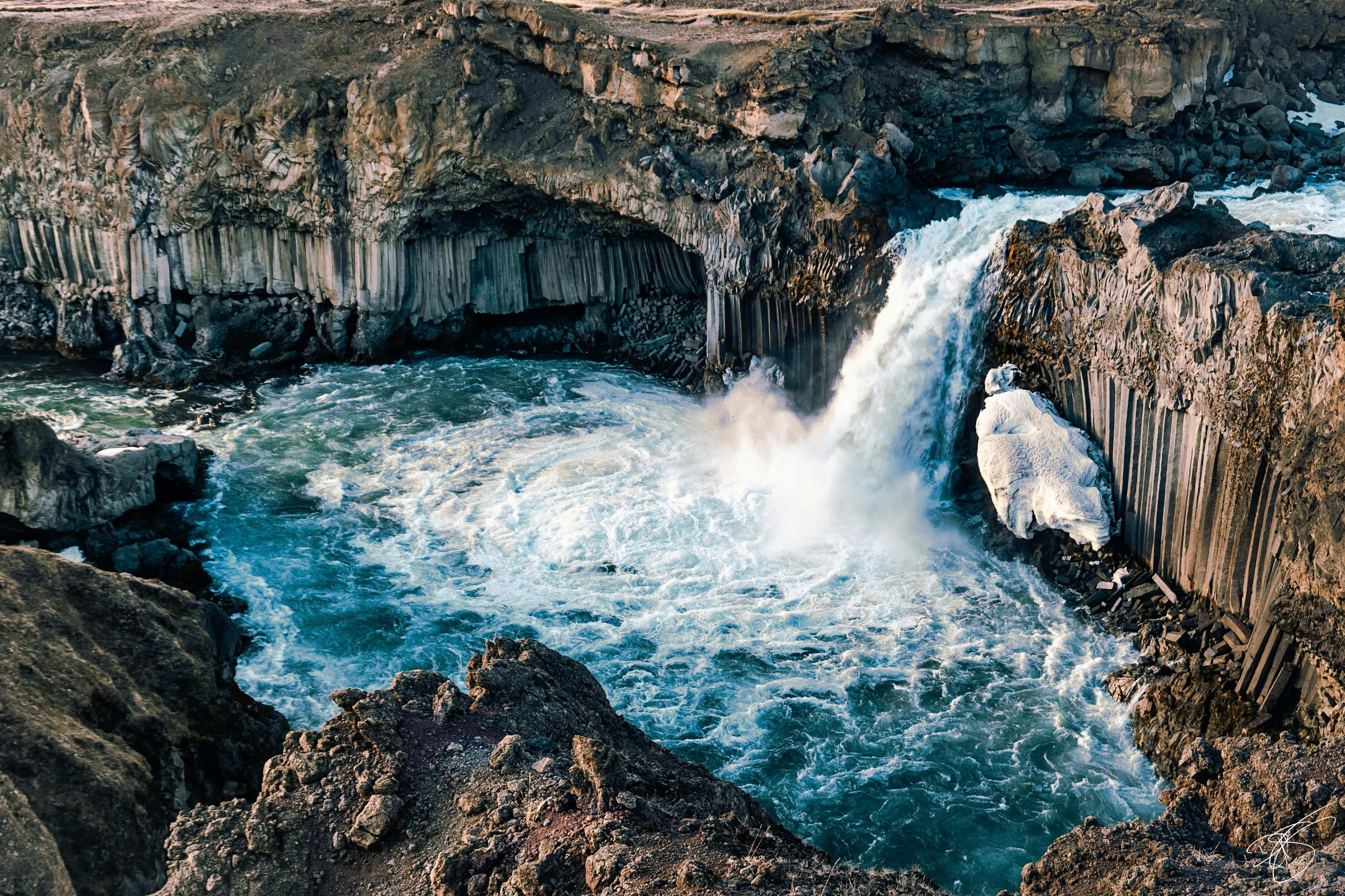
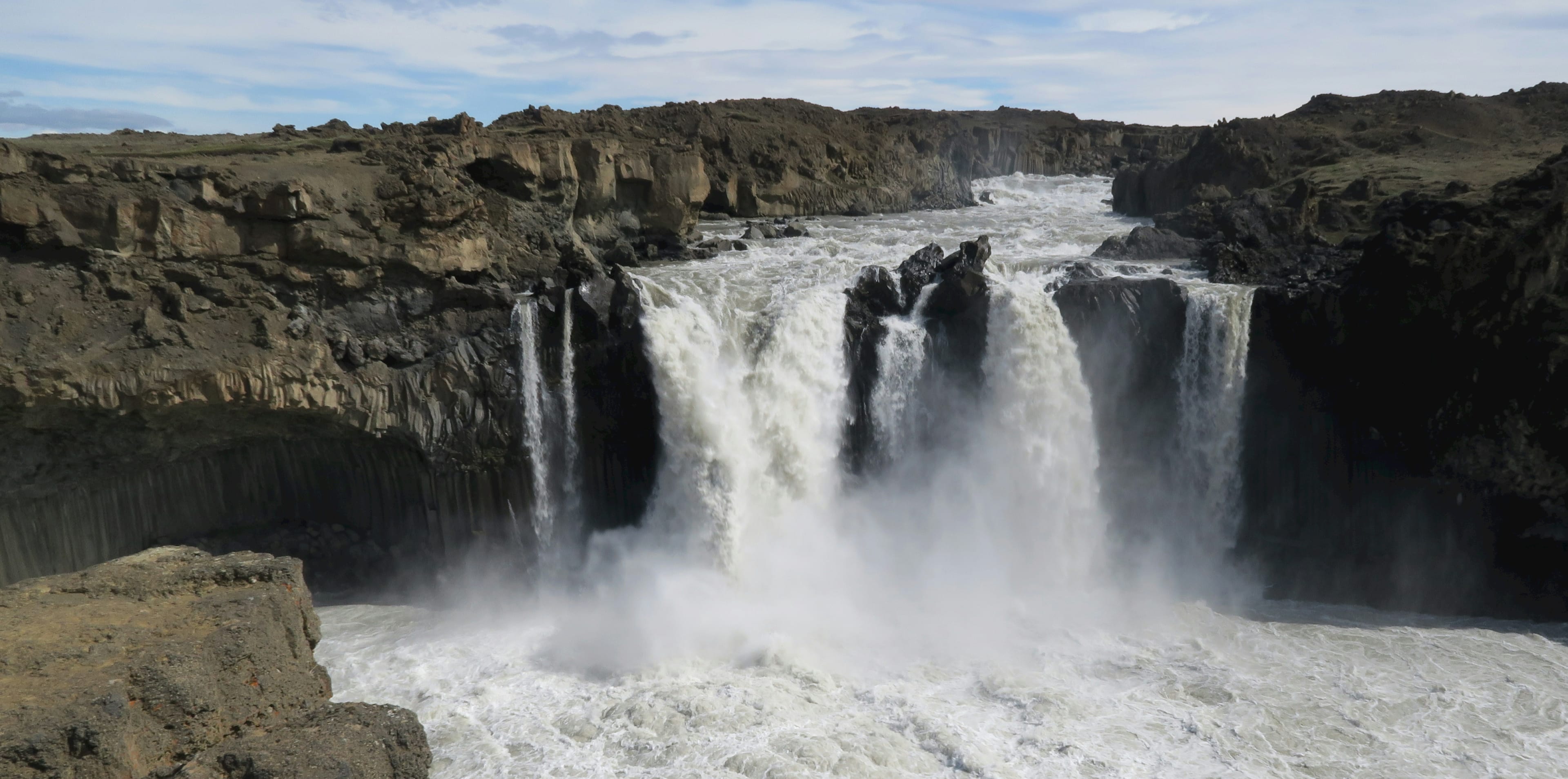
Aldeyjarfoss
Reason for inclusion: Among Iceland's many enchanting hidden gems, Aldeyjarfoss stands out as a particularly striking example. Located on the northern edge of the F26 Sprengisandsleið road, the longest mountain road in the Icelandic highlands, Aldeyjarfoss is fed by the Skjálfandafljót river. The water cascades down from a height of 20 meters into a cold pool surrounded by symmetrically arranged basalt columns, marking the marks of volcanic activity. This contrasts sharply with the waterfall's flow, creating a perfect fusion of natural power and delicate aesthetics.
Location information: Northern edge of F26 Sprengisandsleið highway
How to get there: Most visitors to this lesser-known waterfall choose to start from their base in Akureyri , heading east along Ring Road 1 to Highway 844, then turning right inland. Follow this road onto Highway 842, then continue onto F26. The remaining journey involves traversing ordinary gravel roads.
(Continuing south for another five minutes, you'll reach the sparsely populated but equally breathtaking Hrafnabjargafoss. This waterfall has a dual structure, separated by a large rocky island. The main section is wide and spectacular, with water cascading down from a great height to form a small bowl-shaped canyon, like a natural amphitheater. On the other side, a series of smaller waterfalls and rapids cascade gracefully from the rocky island, adding a touch of delicate beauty.)
The town of Borgarfjörður Eystri
Reason for inclusion: Iceland boasts numerous birdwatching spots, and the small town of Borgarfjörður Eystri in eastern Iceland is one of them. This fishing village, with a population of only about 100, is a paradise for Iceland's national bird, the puffin. Far from the ring road, the town is surrounded by beautiful mountains, with majestic peaks in the distance capped with eternal glaciers that shimmer silvery-white in the sunlight. Magnificent fjords gently embrace the town, and the rocks along the coastline have been sculpted by the waves into ever-changing shapes. Every summer, these adorable and captivating seabirds flock here.
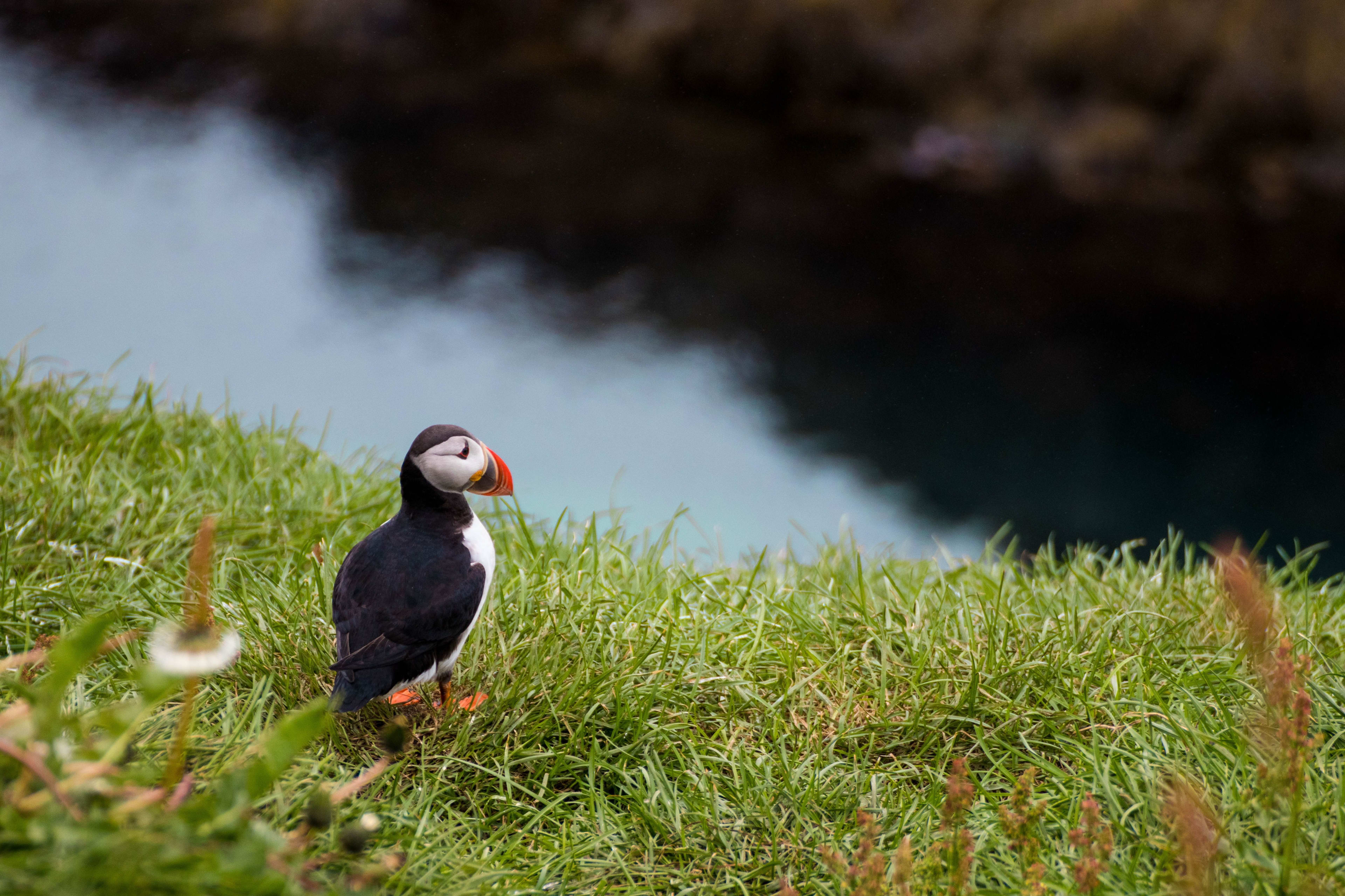
Witnessing them in Puffin's natural habitat is undoubtedly a dream come true for birdwatchers. Furthermore, the area is perfect for hiking. Delving into nature's embrace along winding trails, you'll find yourself walking on the footsteps of history with every step, and capturing breathtaking beauty at every glance. However, the road to the town is quite treacherous, requiring you to cross an unpaved mountain pass and navigate around some cliffs along the fjord. When shrouded in mist, the town takes on a unique charm, with its colorful mountains, valleys, waterfalls, ponds, and rainforests resembling something straight out of a fairytale.
Another fascinating aspect of this town is that it's the birthplace of the Elf Queen. You can walk to Álfaborg Mountain—the "Elf Castle"—where the Icelandic Elf Queen's palace is said to be located. If you're interested in Icelandic elf legends, you might also check out our other guide: Five of Iceland's Most Mysterious Folklore .
Location information: Eastern Iceland, approximately 70 km from Eilstadz and approximately 92 km from Seyðisfjörður.
How to get there: It only takes about 1 hour to drive from either of the two places mentioned above.
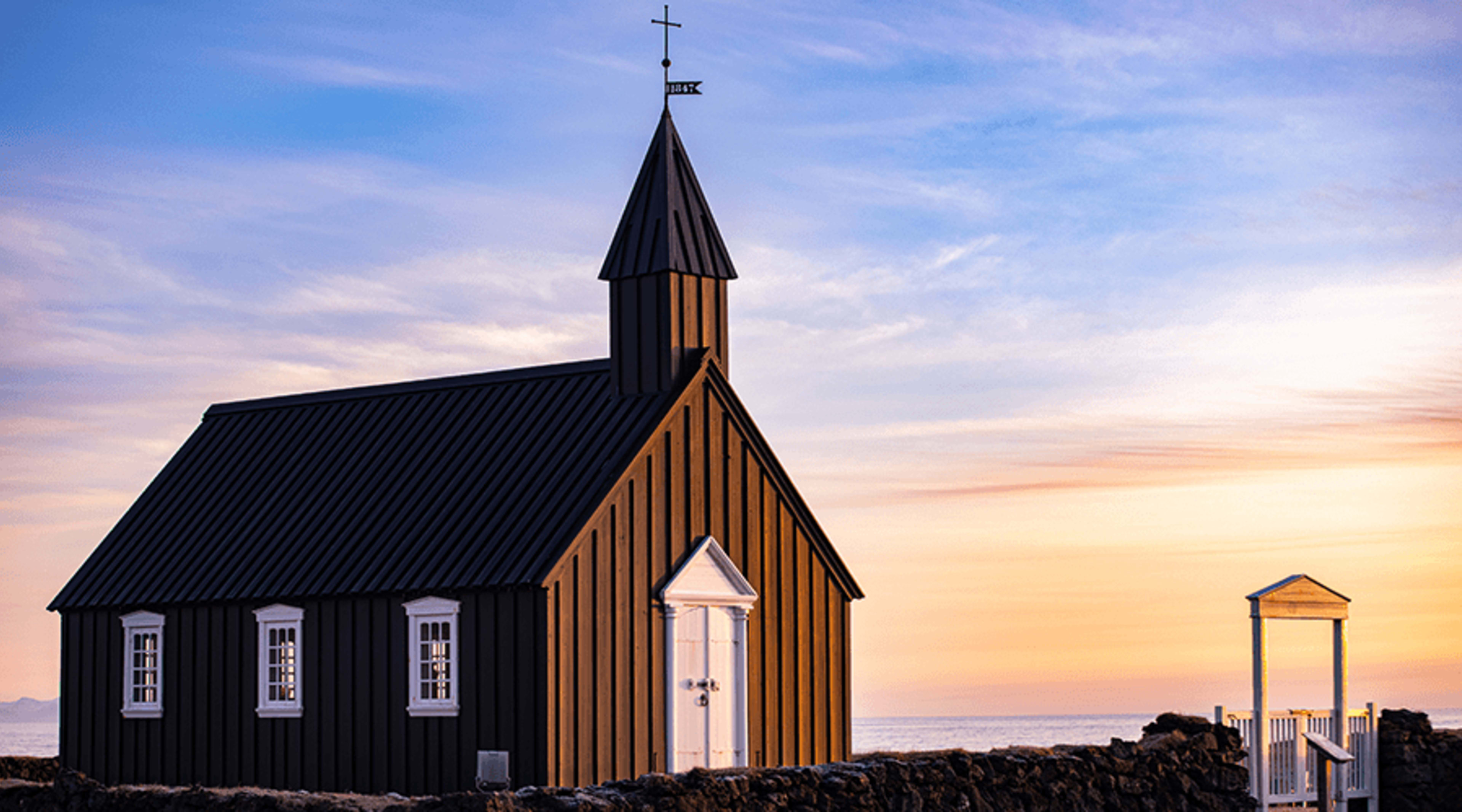
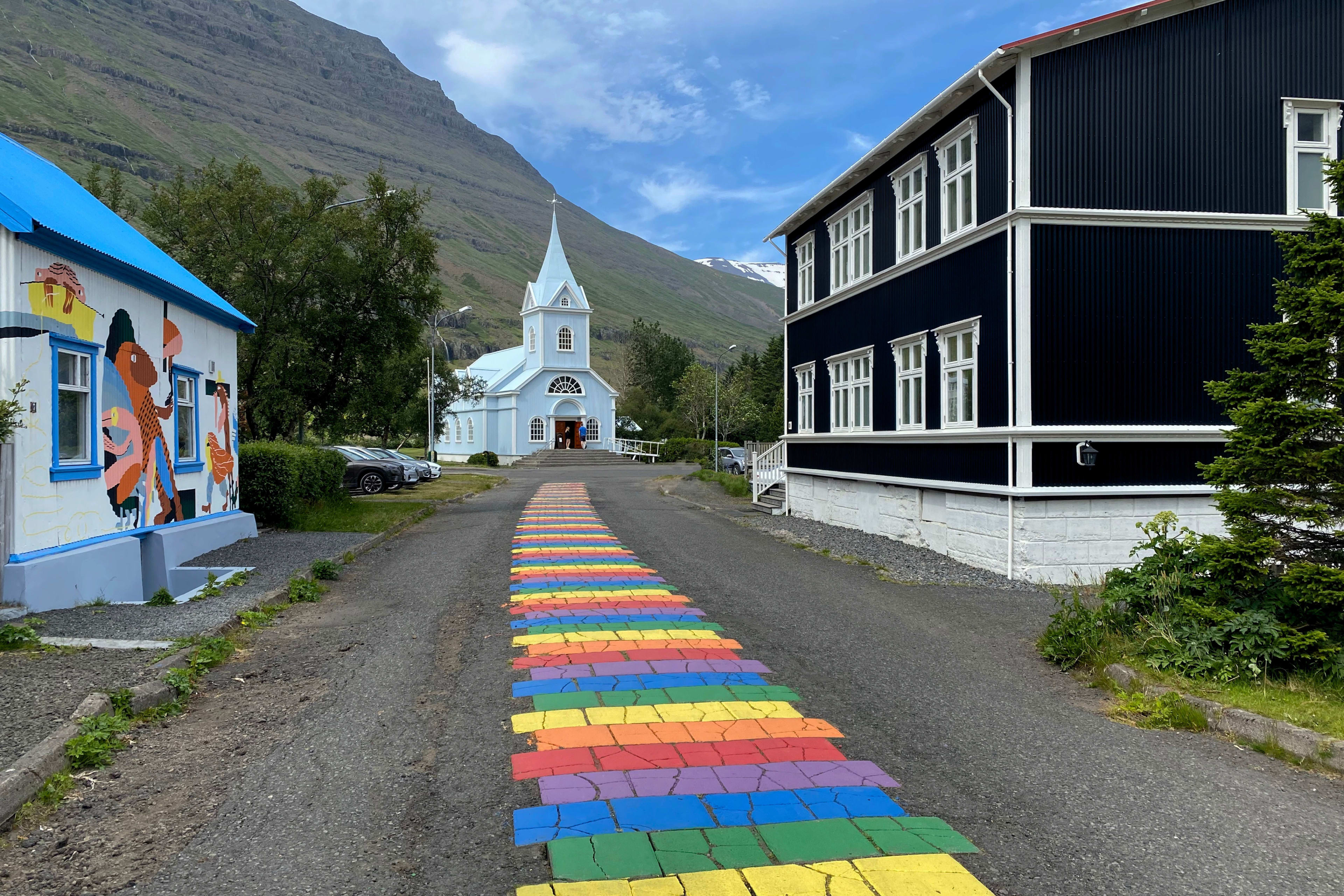
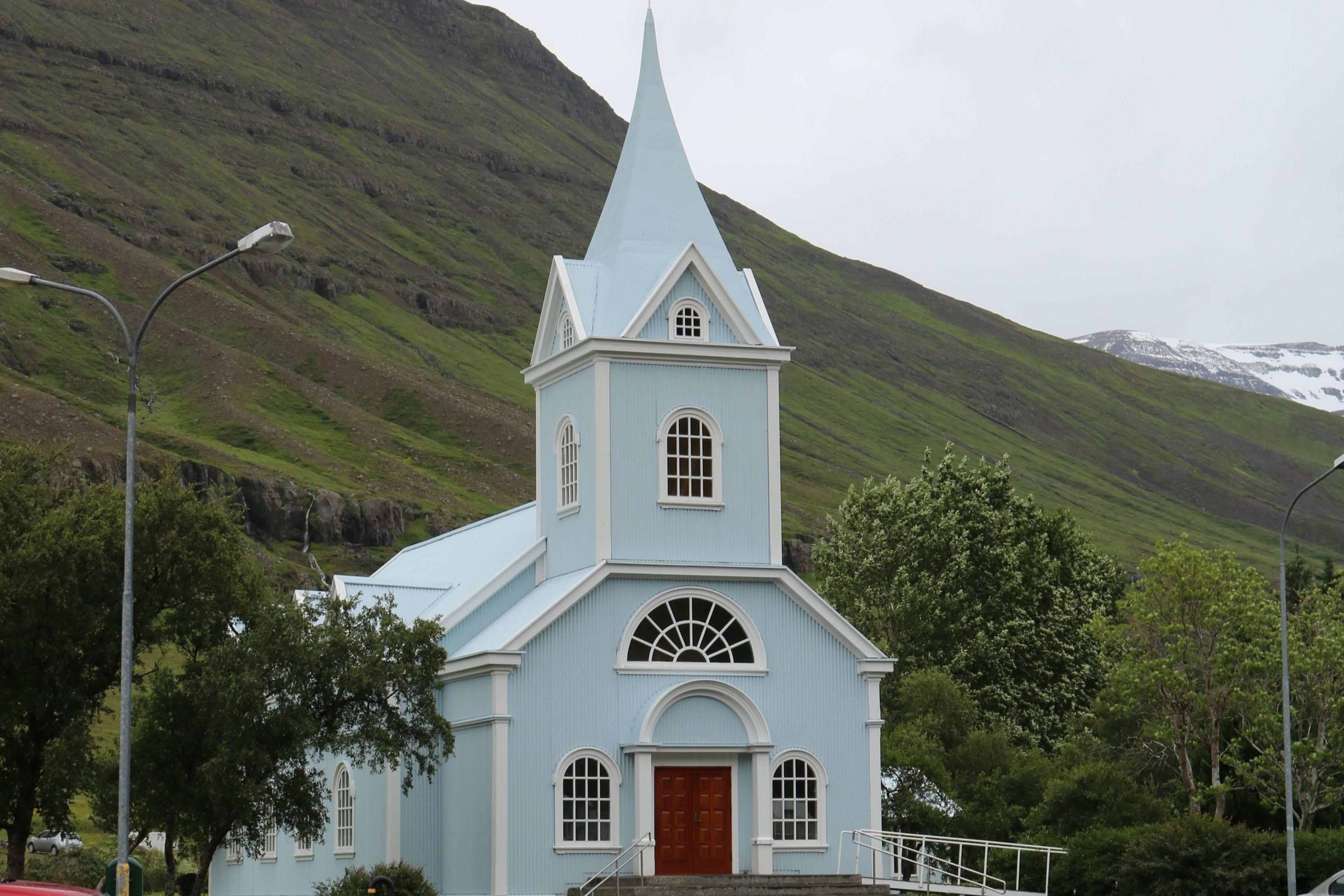
Rainbow Road Church (Seyðisfjörður Church)
Reason for inclusion: Have you already seen the adorable Seyðisfjörður Church flooding social media with pictures of it? This historic church, located in the town of Seyðisfjörður , originated on a farm in Dvergasteinn and moved several times before settling in its current location. With its traditional Icelandic architecture, distinctive blue exterior, and nestled amidst mountains and lush greenery, a rainbow-colored path leads to the pale blue church, adding a vibrant touch to the town's otherwise subdued landscape. In summer, the church is open to tourists.
Location information: Seyzisfjörður, East Iceland
How to get there: It takes about 30 minutes from the Ring Road No. 1, then follow Highway 93 to reach the destination.
Travel Tips: If your trip to Iceland allows time, consider adding the Rainbow Road Church to your itinerary. With increasing exposure on social media, more and more people are taking photos along the rainbow road leading to the church, and this hidden gem is becoming increasingly well-known. Why not discover this lesser-known Icelandic destination sooner rather than later?
Related article: Iceland's ten most distinctive churches
Klifbrekkufossar Waterfall
Reason for inclusion: You've probably seen many single-tiered waterfalls, but how about a multi-tiered one? It's not that single-tiered waterfalls aren't beautiful, but the endless tiers of a seven-tiered waterfall are truly irresistible! This describes the hidden treasure of Iceland's eastern fjords—Klifbrekkufossar waterfall. Located in the Mjóifjörður fjord in eastern Iceland, Klifbrekkufossar is remote but absolutely worth a visit. Klifbrekkufossar means "climbing slope waterfall" because its shape resembles a series of stairs climbing a cliff edge—doesn't that immediately convey the waterfall's tiered nature? The waterfall is 300 feet (91 meters) high, but due to the varying heights of its sections, many people don't accept calculating its total height. Unlike waterfalls formed by glacial rivers, Klifbrekkufossar's source, Fjarðará, is a spring-fed river, making it exceptionally clear and pure. Although there is no official hiking area for Klifbrekkufossar waterfall, it is located near a bend in the Mjóafjarðarvegur (Highway 953) and can be seen from the car.
Location information: Near the bend in Mjóafjarðarvegur (Highway 953)
How to get there: It is about 410 miles (660 km) from Reykjavik. Travelers from Reykjavik can drive to Eilstazy and then 16.1 miles (25.9 km) east to reach the falls.
Important notes for visitors: Only four-wheel drive vehicles are allowed to enter; vehicles are generally prohibited from reaching the site during winter.
Flatey Island
Reason for inclusion: Flatey Island, 2 kilometers long and 1 kilometer wide, is located in Breiðafjörður. Its colorful houses, abundant birdlife, and tranquil atmosphere make it a perfect escape from the bustling mainland.
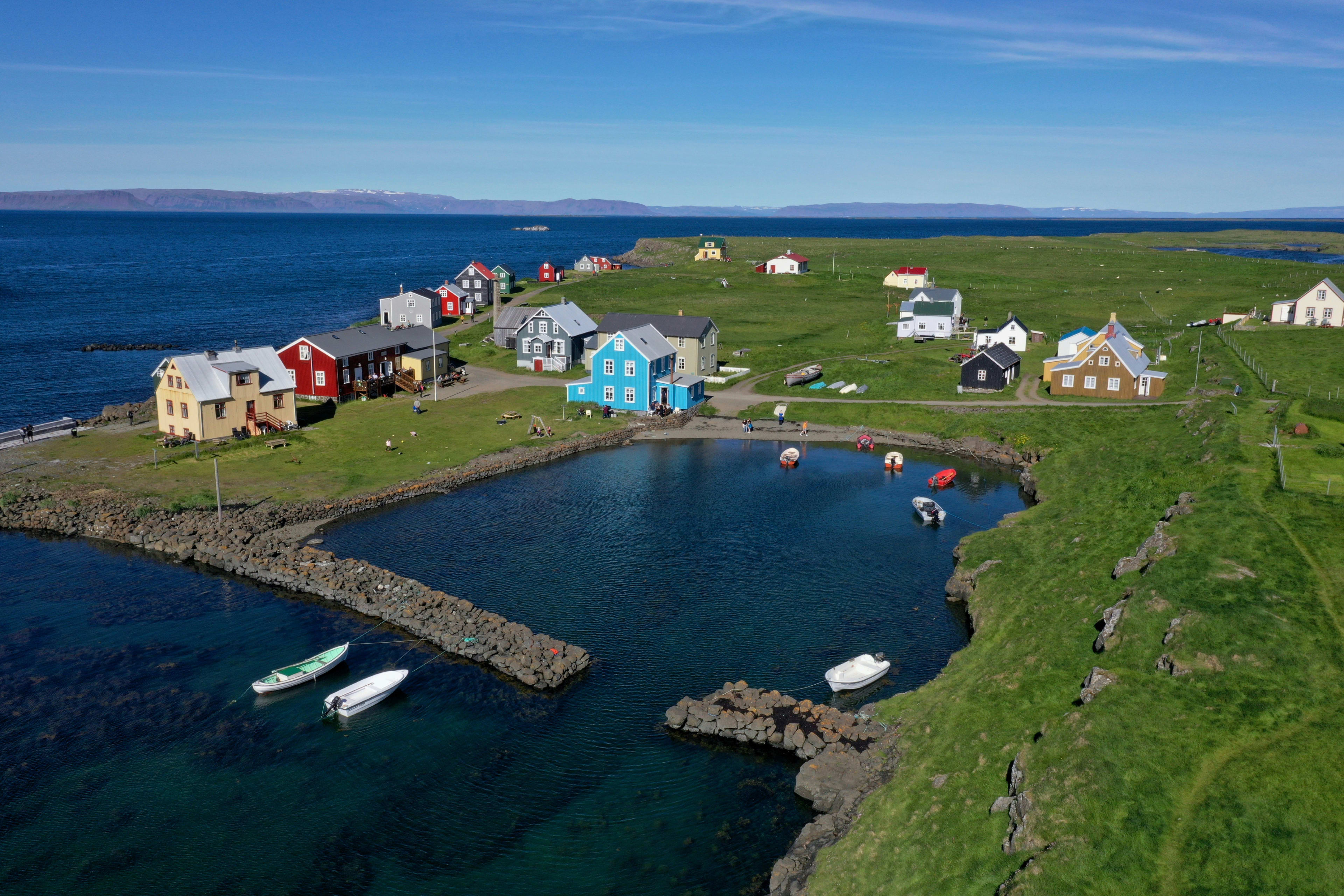
If you were to describe what it's like to live on this island, the words "simple" and "tranquil" would suffice.
From the moment you step onto the island's shore, time seems to stand still. The island's lush greenery and tranquility waft in through the gentle breeze. Surrounded by shimmering waters, the island's wetlands and grasslands provide ideal habitats for various birds, making it a great spot for birdwatching. Why not bring your binoculars and explore?
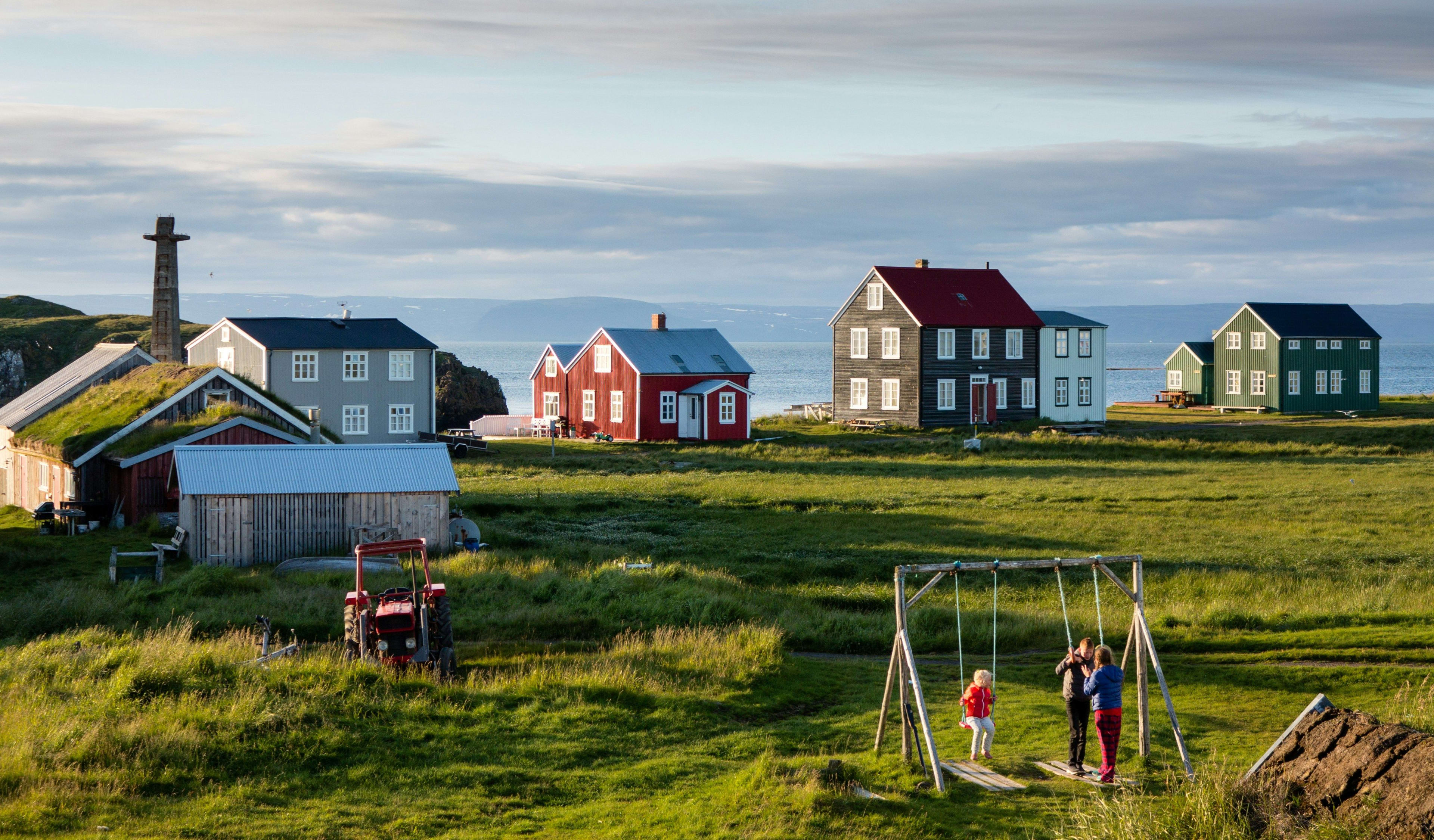
There's also a lovely hotel on the island (Hotel Flatey), where you can fully enjoy the island's peace and tranquility – a true paradise. In the first rays of morning sunlight, you might hear the melodious chirping of birds, and step outside to see Iceland's unique puffins; their bright beaks and adorable appearance are sure to bring a smile to your face.
Location information: Breiðafjörður, Iceland
How to get there: You can only reach it by ferry from Brjánslækur or Stykkishólmur .
Important notes for visitors: Open to visitors only during the summer months of June to August.
To learn more about the islands of Iceland, please see The Most Worth Visiting Islands in Iceland .
Ásbyrgi Gorge
Reason for inclusion: Ásbyrgi Gorge, boasting numerous scenic hiking trails, is one of the most unique places in northeastern Iceland. It's a place where captivating natural scenery, mythology, ancient legends and culture, and hiking trails converge. Legend has it that this is where Sleipnir, Odin's steed in Norse mythology, first appeared, forming a massive U-shaped horseshoe-shaped gorge upon landing. However, its formation was actually due to a flood called Hlaup (meaning "running!"). The gorge is breathtaking in all seasons, especially in autumn when the leaves change color, creating a vibrant tapestry of hues. Hiking through the forest, sunlight filters through the sparse canopy, casting dappled shadows on the ground.
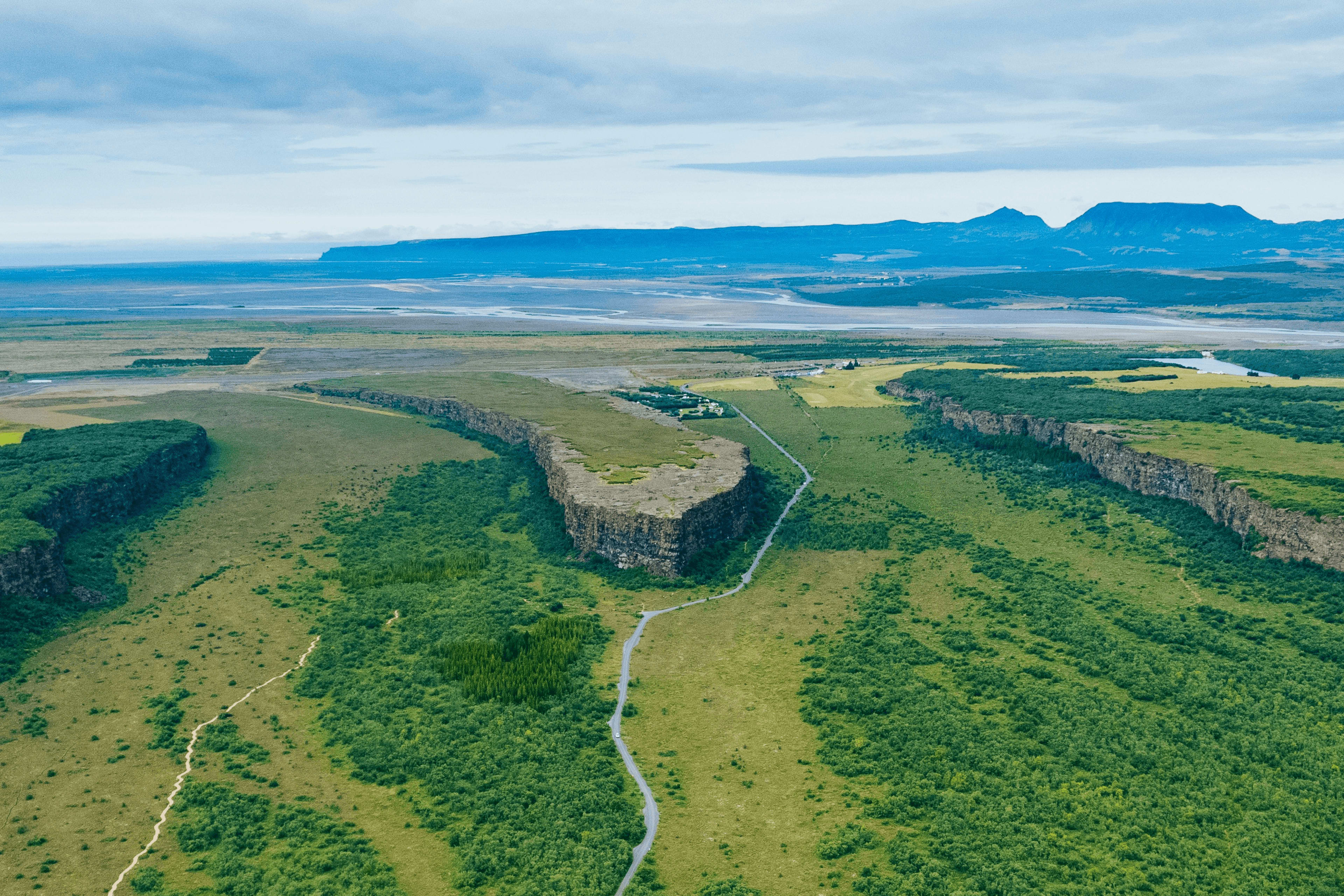
Autumn in Asbighi is like nature's last carnival, its most splendid display before the silence of winter.
Icelanders say fairies are everywhere, and if you're looking for them, this is an excellent place to go. However, whether you believe in fairies or not, Asbjökull, this horseshoe-shaped canyon, is a perfect place for adventure. The canyon trails are secluded, and you can take advantage of the ample time to explore its endless wonders, especially in the summer when the sun is still high in the sky at midnight.
Location information: Located in the Diamond Circle area of northern Iceland, part of Vatnajökull National Park, about 60 kilometers from Húsavík , known as the "whale watching capital of Europe," adjacent to Highway 85, and not far from Dettifoss .
How to get there: Take Highway 85, then turn onto Highway 861, which will eventually take you to the visitor center, campsite, and trails.
Stonehenge (Arctic megalithic monument)
Reason for inclusion: Located in Raufarhöfn, one of Iceland's most remote towns, Stonehenge's unique geographical location imbues it with a sense of isolated solitude. Standing before this structure of massive basalt formations, a profound sense of loneliness and mystery arises. These stones seem like ancient guardians, silently recounting stories from Norse mythology. Similar to other iconic megalithic sites, Stonehenge features various stone arches and statues arranged according to pagan beliefs, inspired by the Norse mythological poem "Völuspá" (The Prophet's Prophecy). Designed as a giant sundial, the interplay of light and shadow reflects the passage of time. This fusion of ancient mythology and modern art prompts reflection on the relationship between humanity and nature, tradition and modernity.
Once completed, Stonehenge will be approximately 52 meters (171 feet) in diameter and currently features four gates symbolizing the four seasons and a central decoration. Despite being under construction, visitors can already immerse themselves in its mystical atmosphere. This less-traveled location is breathtaking on foggy days, with a grey mist shrouding the structure in a captivating veil of mystery. Once completed, you can see the light shining through the "portals." In winter, many choose to visit at night in hopes of witnessing the beautiful Northern Lights.
Location information: Raufarhöfn town
How to get there: The drive from Akureyri to Stonehenge takes less than three hours: drive east on Ring Road 1, then turn right onto Highway 85. Follow this road through Husavik, and turn left when you see a sign for Raufarhöfn. Stonehenge will be visible as you approach the town.
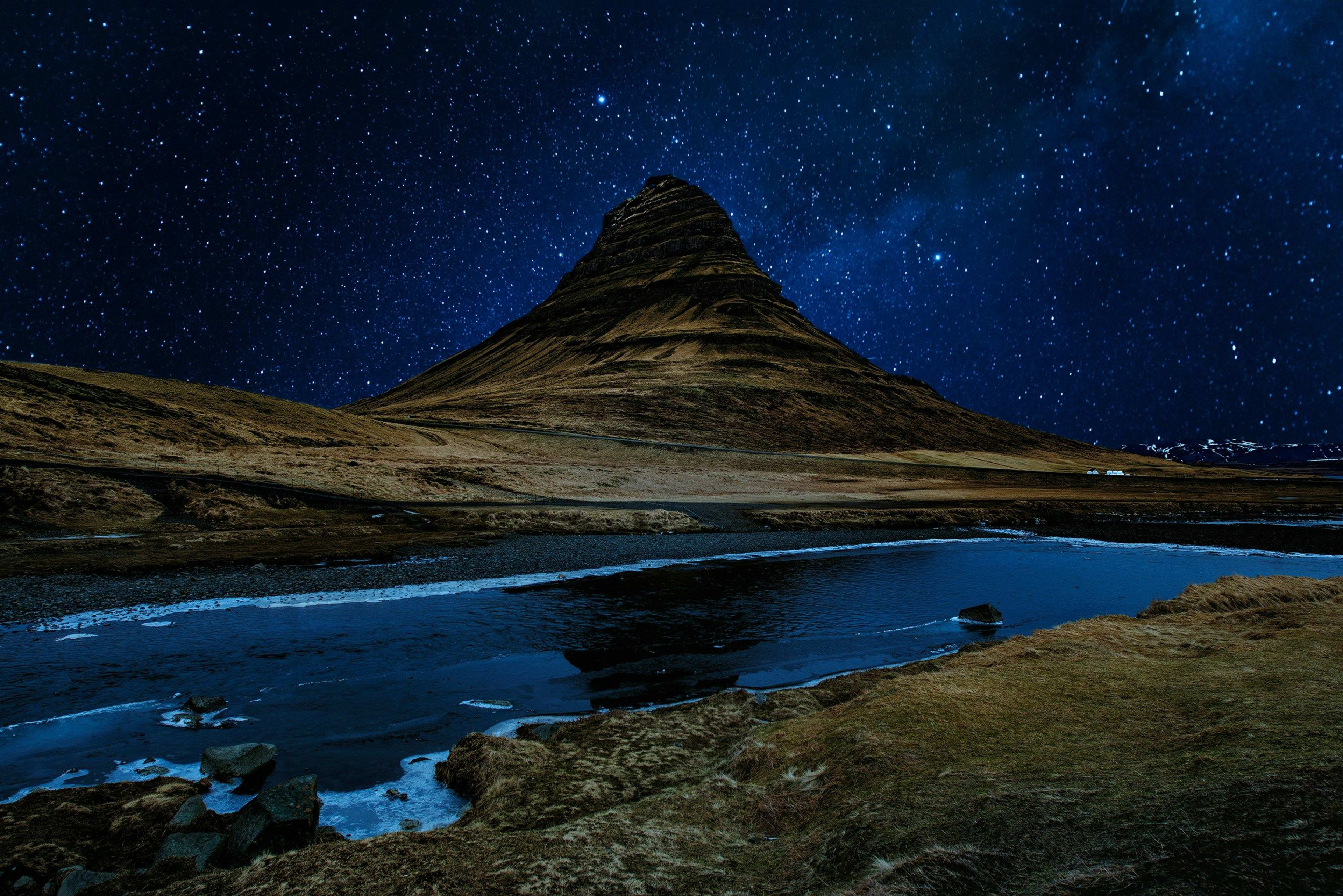
Snæfellsnes Peninsula
Ingjaldshólskirkja Church
Reason for inclusion: What? You only know Búðakirkja in Snæfellsnes Peninsula ? Most people who come to Snæfellsnes Peninsula simply visit Búðakirkja and Kirkjufell , but few people notice that the red-roofed Ingjaldshólskirkja Church is also located in this magical "snow-capped peninsula".
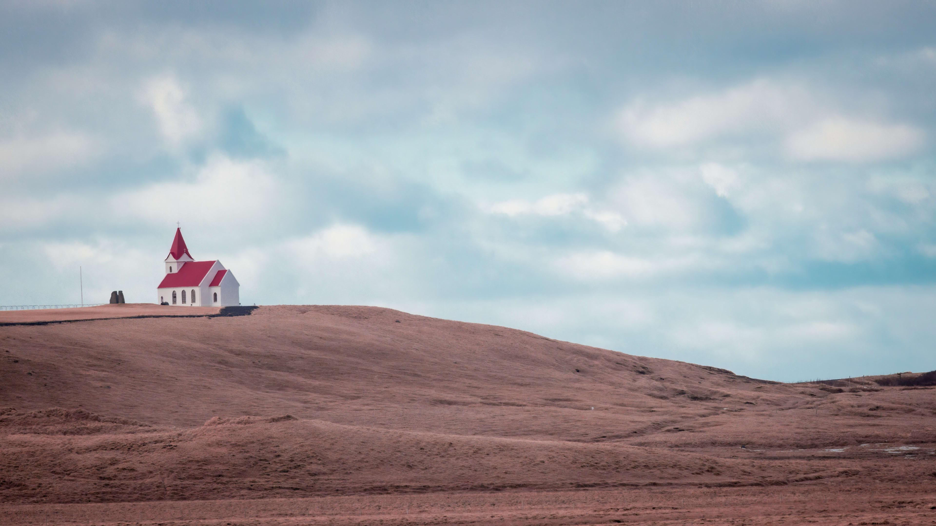
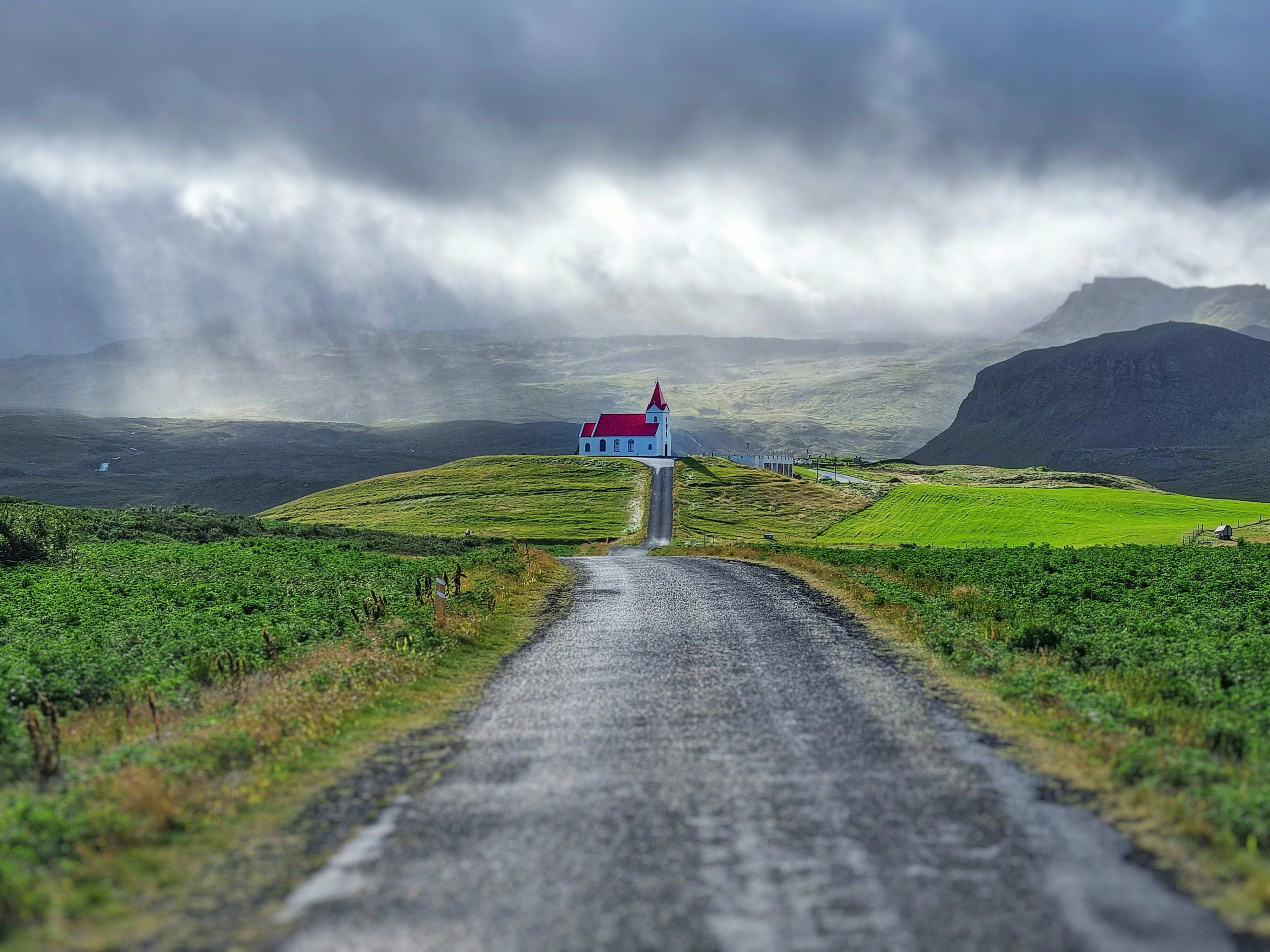
It must be said that the red Ingjaldshólskirkja church, against the backdrop of vast meadows and distant mountains, creates a striking visual contrast, standing out vividly against the surrounding green landscape and becoming a beautiful sight. If you're traveling by campervan, consider visiting Ólafsvík, a town with excellent campsites, to take in the beautiful coastal scenery.
Location information: Northern Snæfellsnes Peninsula
How to get there: The church is located on the north side of the peninsula and is easily accessible by car. The long driveway is a great spot for taking photos, and there is also parking on the roof of the church.
To find this church, you can add a visit to the Snæfellsnes Peninsula to your Icelandic summer 12-day romantic self-drive tour around the island: the Ring Road & Snæfellsnes Peninsula will satisfy your needs!
Monster Cliff (Lóndrangar)
Reason for inclusion: Lóndrangar , also known as Monster Cliffs, is another must-see sight on the Snæfellsnes Peninsula. Majestic rock pillars, sculpted by seawater and wind, rise steeply to 75 meters (246 feet) and 61 meters (200 feet). The cliffs are also a rich bird habitat, providing nesting grounds for numerous birds, including puffins and guinea pigeons.
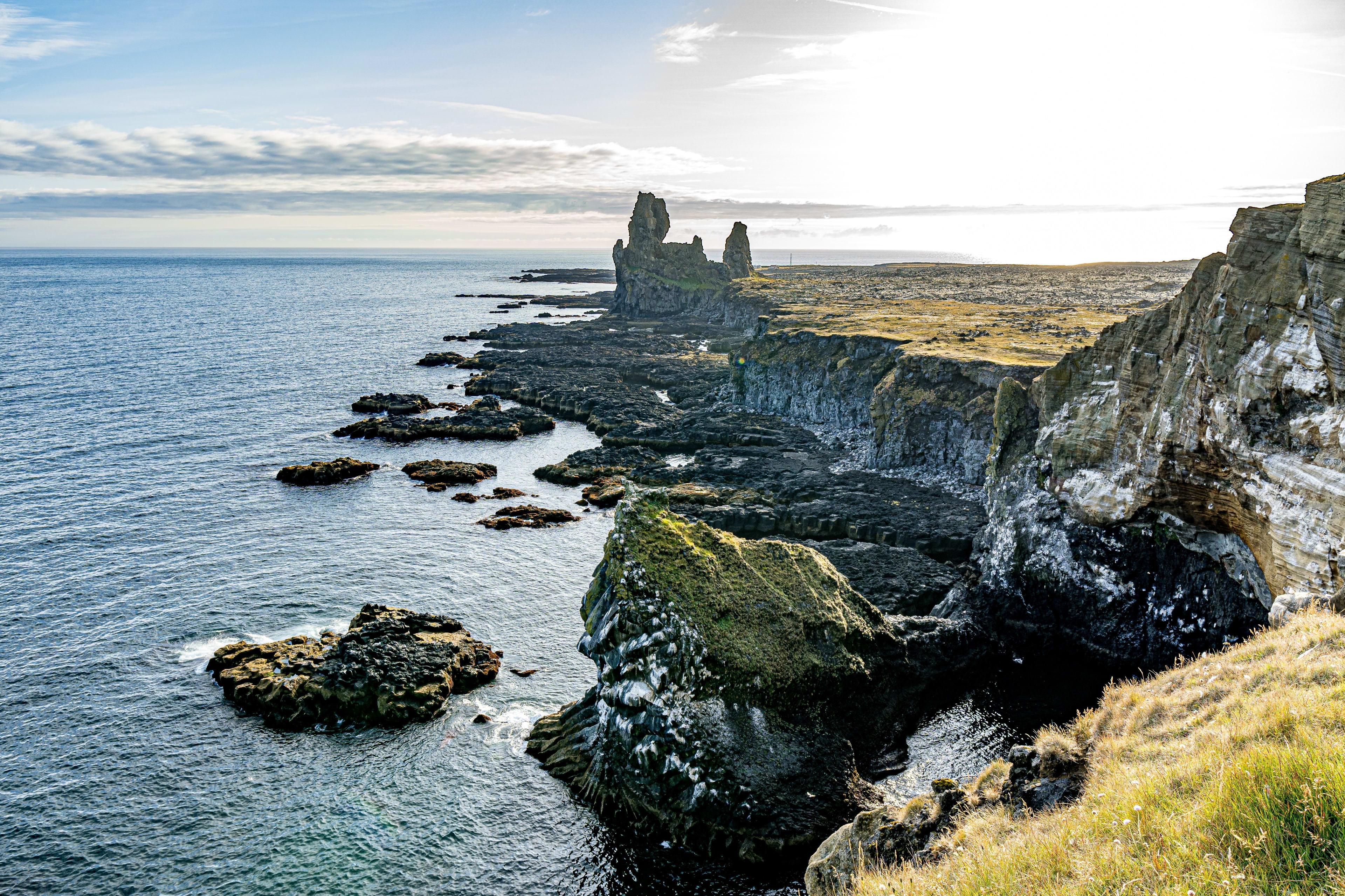
Location information: Southwest of the Snæfellsnes Peninsula
How to get there: By car or by tour group
Related group tour itineraries:
West Iceland
Rhinoceros Stone (Hvítserkur)
Reason for inclusion: For wildlife enthusiasts, the Vatnsnes Peninsula is a hidden gem. However, the most eye-catching feature of the Vatnsnes Peninsula is a 15-meter-high basalt monolith called Hvítserkur . Despite its remote location, this twisted sea-eroded volcanic rock is a true wonder, resembling some mysterious creature. When you see it, you'll be amazed by its unique shape; it looks like a giant drinking dragon, or an elephant with its torso submerged in the sea. Many people generally believe it resembles a rhinoceros, hence the name "Rhinoceros Rock." Of course, feel free to let your imagination run wild!
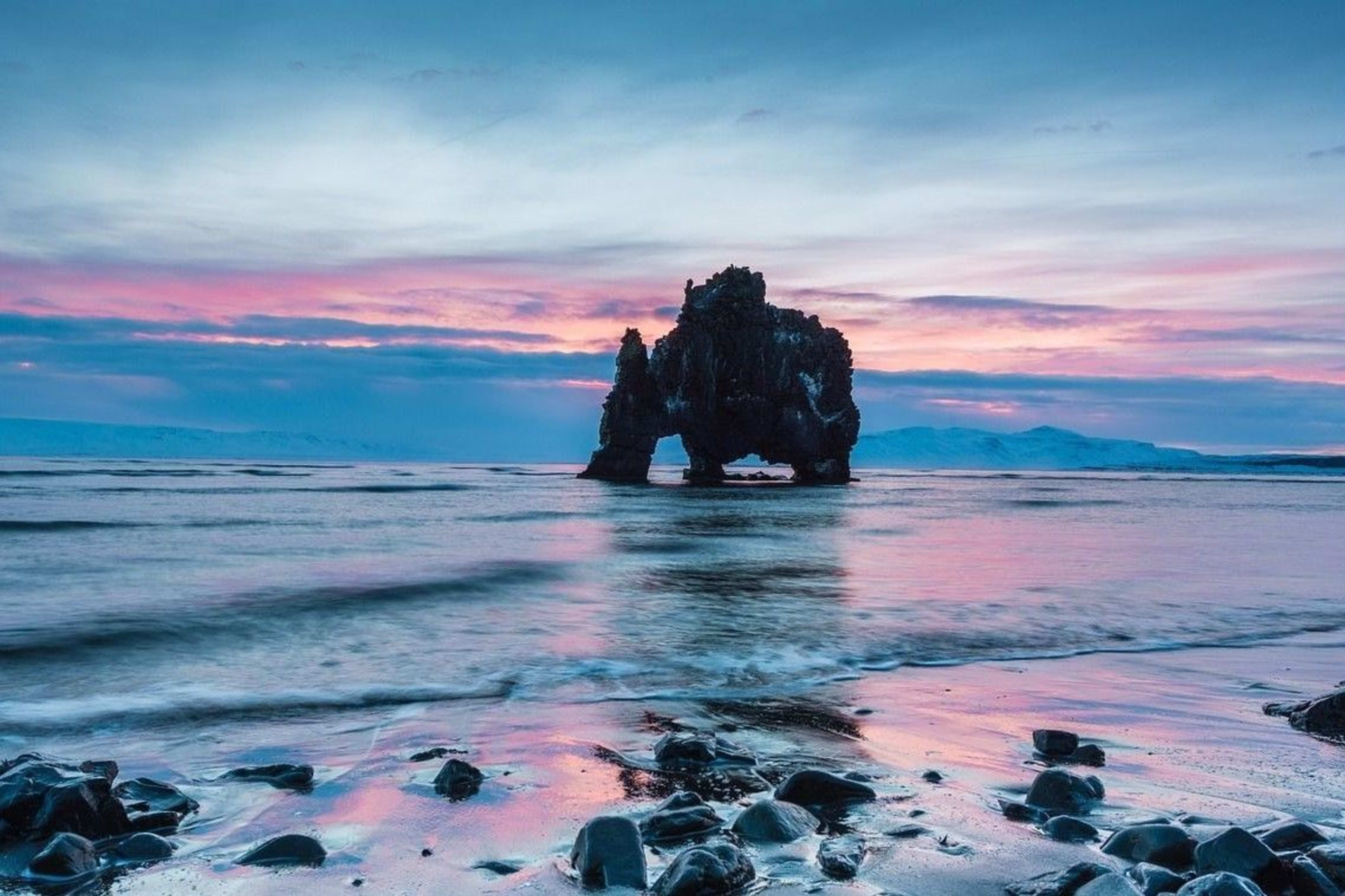
According to legend, Rhinoceros Rock is a giant that cannot find a place to live before sunrise. Especially against the backdrop of a pinkish-purple sky, it stands proudly by the sea, creating a visually stunning scene that has captivated countless landscape photographers.
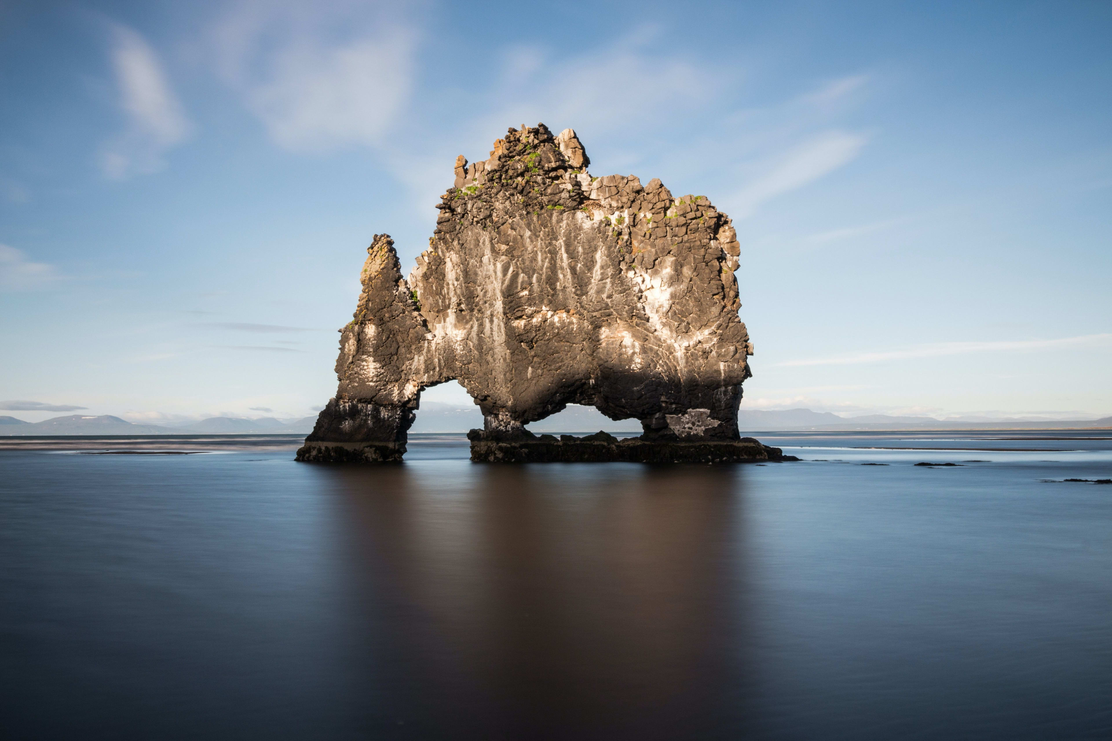
This is also a paradise for local wildlife. While exploring, you might spot various birds, and even seals sunbathing on the nearby shore. If you're lucky, you can often see them lounging leisurely on the rocks – get your camera ready to capture their adorable moments! Besides, the Icelandic name for Rhino Rock, Hvítserkur, means "white shirt," referring to the white bird droppings covering the dark rock surface – quite unexpected, isn't it?
Location information: Vatnsnes Peninsula in Húnaflói, northwestern Iceland.
How to get there: By car, enter Hvítserkur into your GPS. If you're driving counter-clockwise around the island, it's about 200 kilometers west of Akureyri. It's approximately 220 kilometers from the capital, Reykjavik. Take Route 711 from Ring Road 1.
Glymur Waterfall
Reason for inclusion: Iceland is known as the "Land of a Thousand Waterfalls," and while Glymur Waterfall might not be the first thing that comes to mind, it undoubtedly ranks high on any list of waterfall heights. This second tallest waterfall in Iceland, standing at 198 meters (650 feet), is truly awe-inspiring!
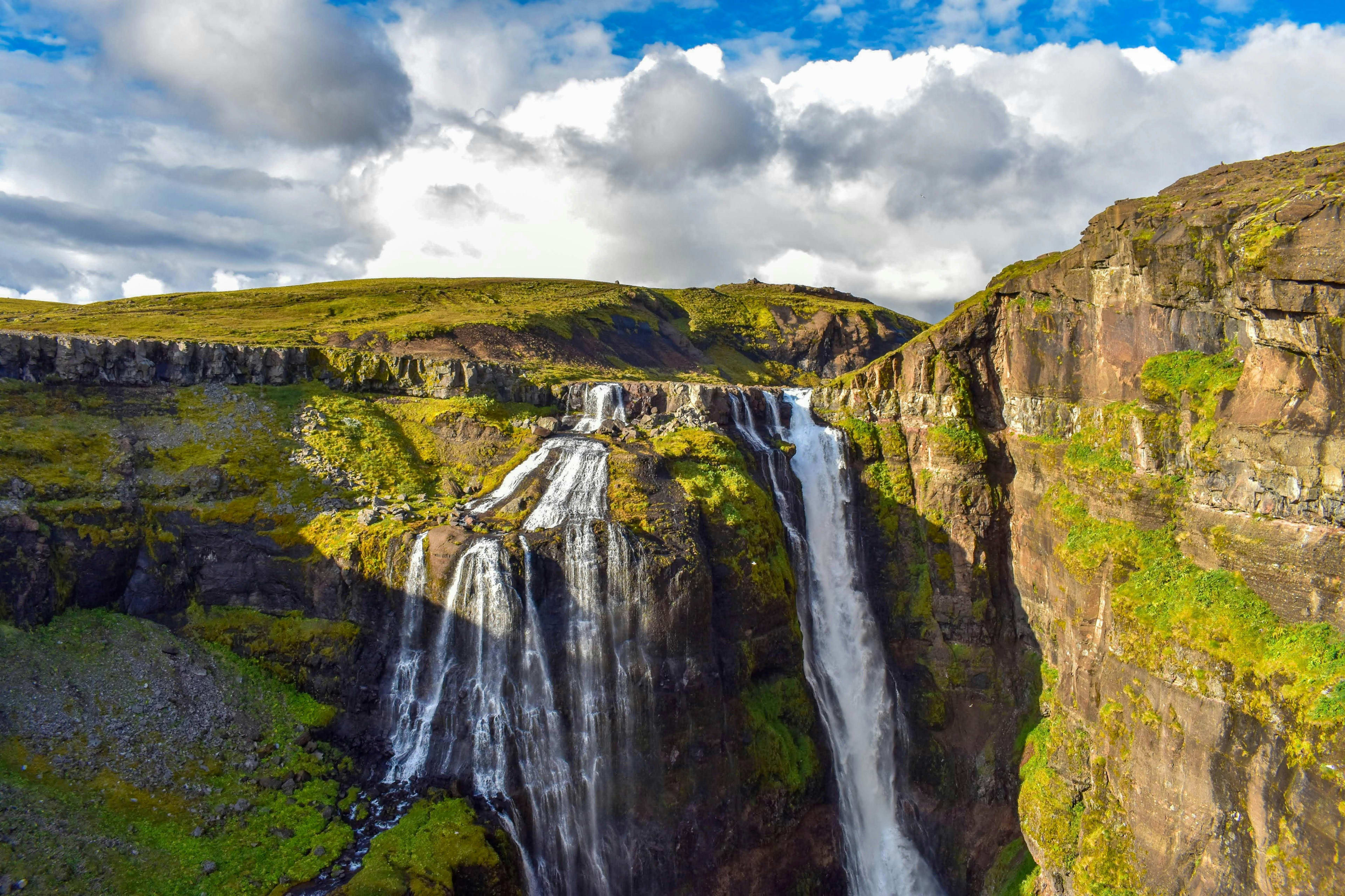
Along the way, you'll be greeted by lush green vegetation, colorful wildflowers, and unique rock formations and valleys. The hiking trail requires wading through a river, traversing a cliffside path, and navigating a cave. It's a challenging experience in some ways, but when you finally witness the towering waterfall, it's all worth it… A friendly reminder: wear sturdy hiking boots and bring a waterproof jacket, as the path near the waterfall can be quite slippery.
Location information: Located in the picturesque Hvalfjörður , just an hour's drive from the capital Reykjavik.
How to get there: After parking, you need to hike to the waterfall, which takes about 3.5 hours.
Reykholt
Reason for inclusion: Follow in the footsteps of Iceland's legend in Reykholt ! Here, you can also experience the boundless beauty of western Iceland. Reykholt is the birthplace of Snorri Sturluson, the famous Icelandic scholar and writer, and holds immense historical value. There is a geothermal pool here called Snorralaug, which is significant because Snorri Sturluson frequently visited it, finding inspiration and solace in its tranquil waters. It represents both Snorri's literary legacy and their close relationship with Reykholt. However, this hot spring is currently protected, and swimming is prohibited.
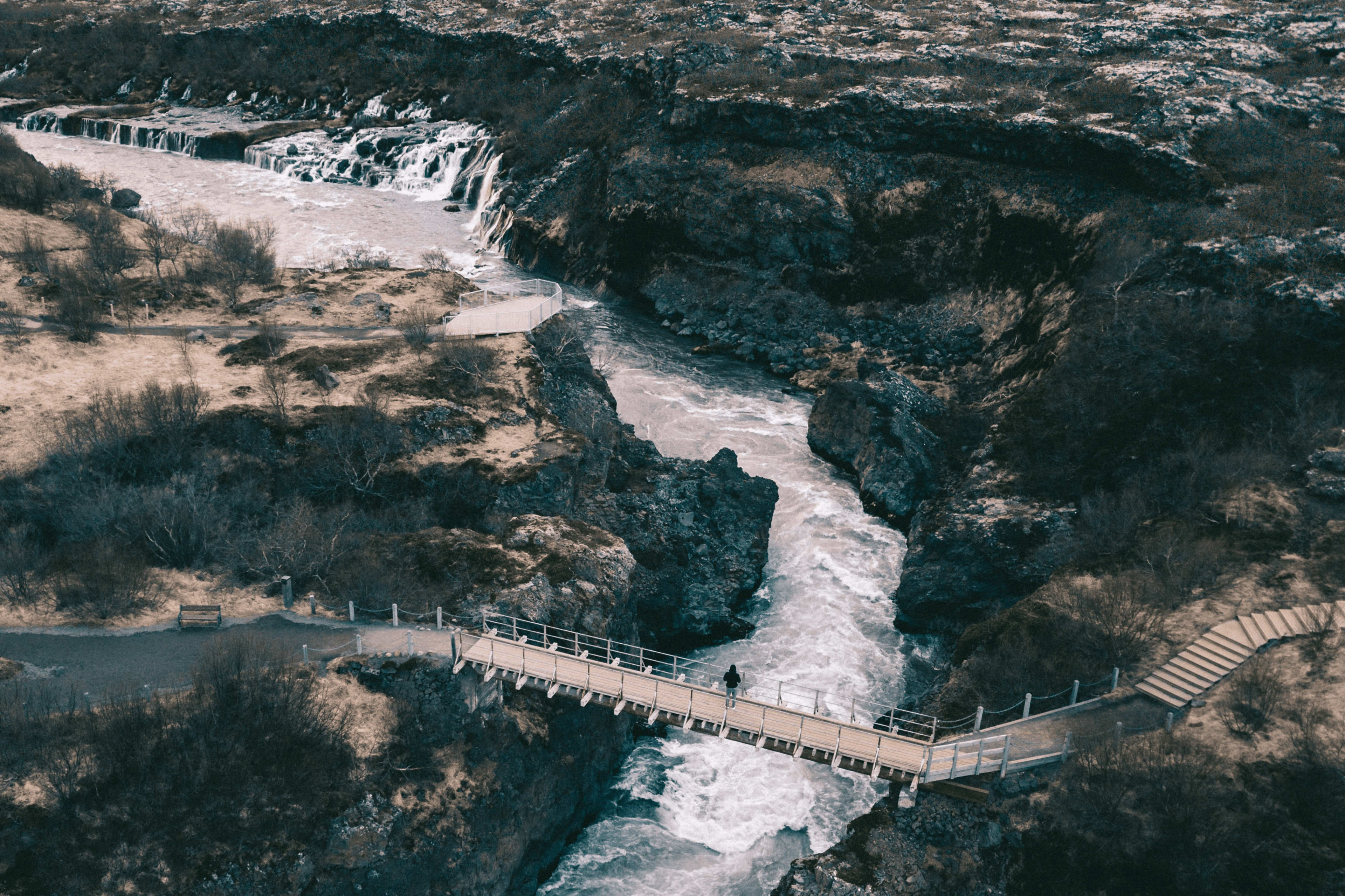
Location information: Located in western Iceland, about 100 kilometers from Reykjavik, and not far from Hraunfossar (lava waterfall) , Barnafossar (children's waterfall) , and Deildartunguhver (hot spring) .
How to get there: By car or by tour group
When you come to Reykholt, you might as well spend a day on a day trip to West Iceland and explore the beautiful scenery of the Silver Circle in western Iceland.
Húsafell
Reason for inclusion: Húsafell is a charming town located at the far end of Iceland's Silver Circle route, surrounded by colorful birch trees and shrubs, making it an ideal spot for capturing beautiful scenery such as mountains, waterfalls, and rivers. Furthermore, it's the birthplace of popular artists Jóhannes S. Kjarval and Páll Guðmundsson, a source of inspiration for emerging artists. On clear, cloudless days, vast farms and massive mountains unfold before your eyes. Looking further afield, you'll see the milky-white peaks of glaciers.
What many people don't know is that if you're spending a day in western Iceland, the perfect way to end your day is at Húsafell Gorge Baths, a stunning geothermal spa hidden in a gorge, where you can also visit another waterfall: the two-tiered Langifoss waterfall.

Location information: Húsafell is located in the Borgarfjord region, 64.5 km from Borgarnes and 132 km from Reykjavik, the capital of Iceland.
How to get there: If you are coming from Reykjavik, it takes approximately 1 hour and 45 minutes to reach Húsafell. Take Highway 1, passing through the Hvalfjarðargöng undersea tunnel, towards Borgarfjordur. Just before the bridge leading to Borgarnes , turn right onto Highway 50. Follow this road until you reach Húsafell.
Westfjord
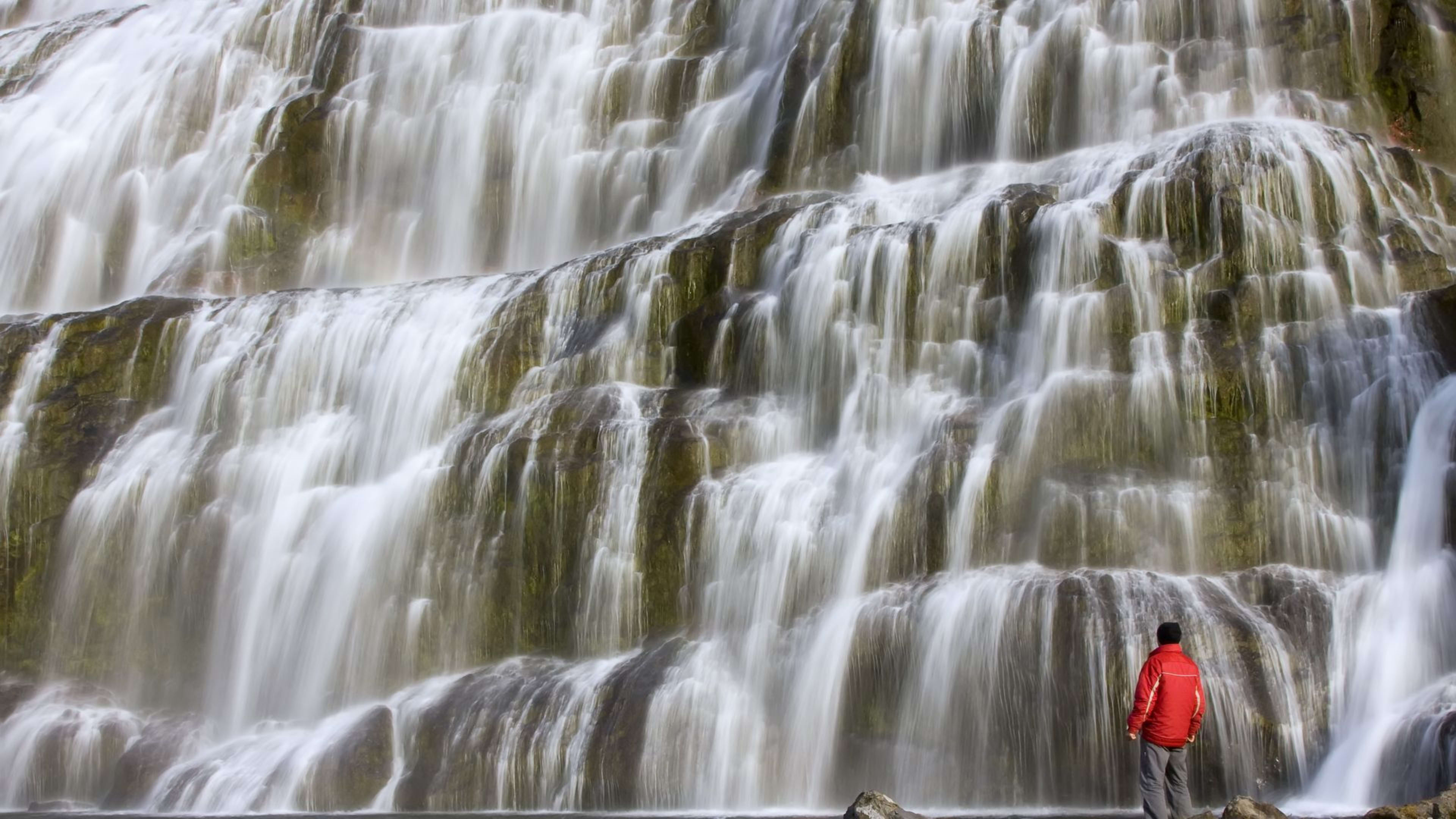
Dynjandi Waterfall
Reason for inclusion: Dynjandi is the largest waterfall in Iceland's Westfjords, known as the "Pearl of the Westfjords." In Icelandic, "Dynjandi" means "thunderous." The waterfall is 30 meters wide, reaching a maximum width of 60 meters at its base, cascading down the mountainside in tiers. As you approach the falls, the first sound you hear is the roar of the water crashing against the rocks, like a natural symphony, leading you into this mysterious realm. When you first see Dynjandi, you may be amazed by its grandeur and power.
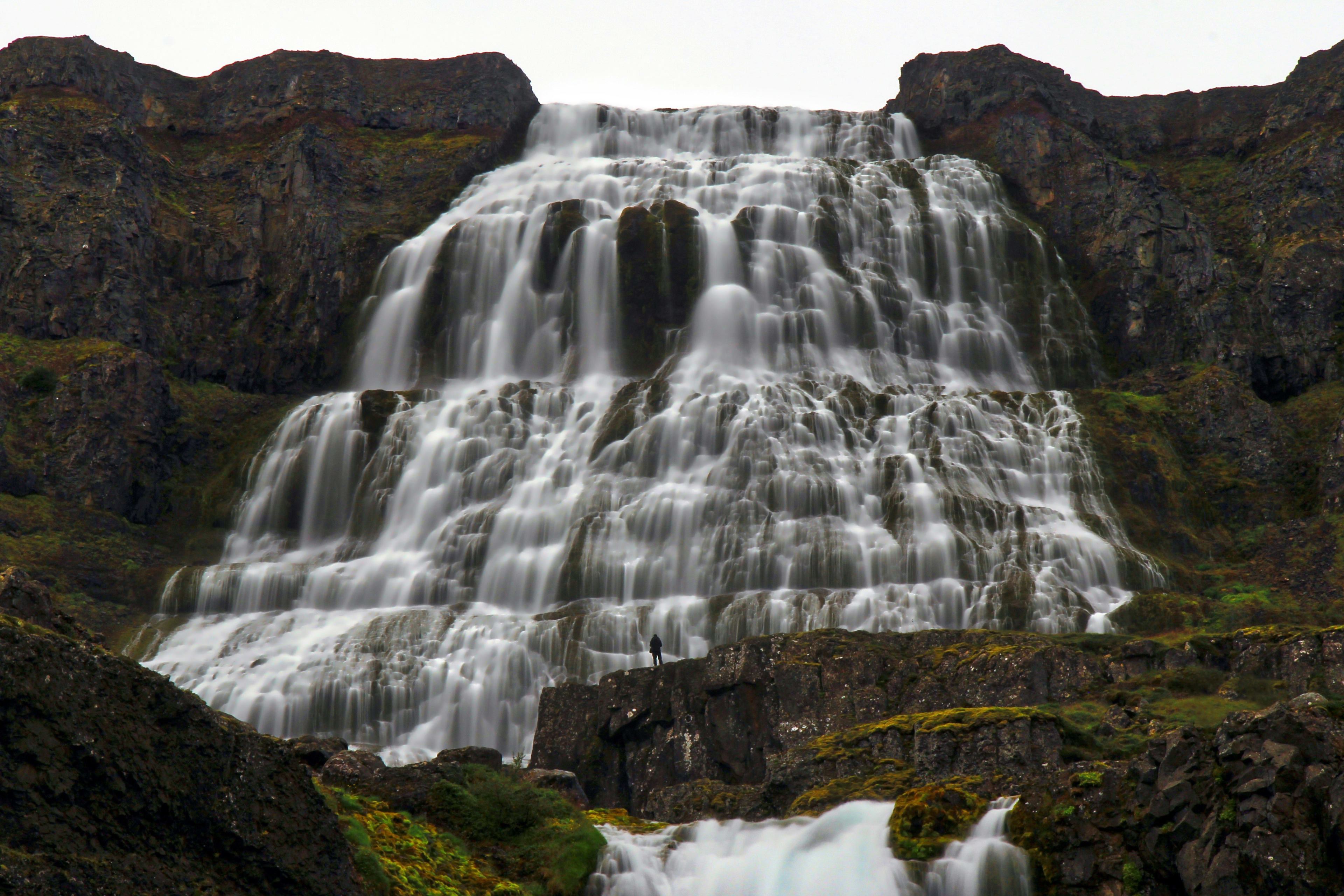
The waterfall cascades down from a great height, forming multiple tiers, each with its own unique shape and characteristics. From the narrow stream at the top to the wide curtain of water at the bottom, the combined flow resembles a giant fan or a stepped pyramid made of water. The surrounding environment is equally captivating: the towering peaks of the fjord region, with lush green vegetation covering their slopes, contrast sharply with the white water of the falls.
Location information: Within the Westfjords of Iceland
How to get there: By car or with a tour. Tinjardi Waterfall is 363 kilometers from Reykjavik, the capital, a long drive that cannot be completed in a day. It is recommended to combine it with other attractions in the Westfjords. The Westfjords have complex terrain, making self-driving challenging. Visitors can also choose to join a bus or super jeep tour, with a professional guide, temporarily leaving the Ring Road (Route 1) to head towards Tinjardi Waterfall; this allows you to fully appreciate Iceland's natural beauty without driving. Visitors who do not choose to drive can also take a domestic flight from Reykjavik International Airport to the Westfjords region.
Important notes for visitors: This area has been a nature reserve since 1981. You need to follow the trails to protect nature and prevent this beautiful place from being damaged.
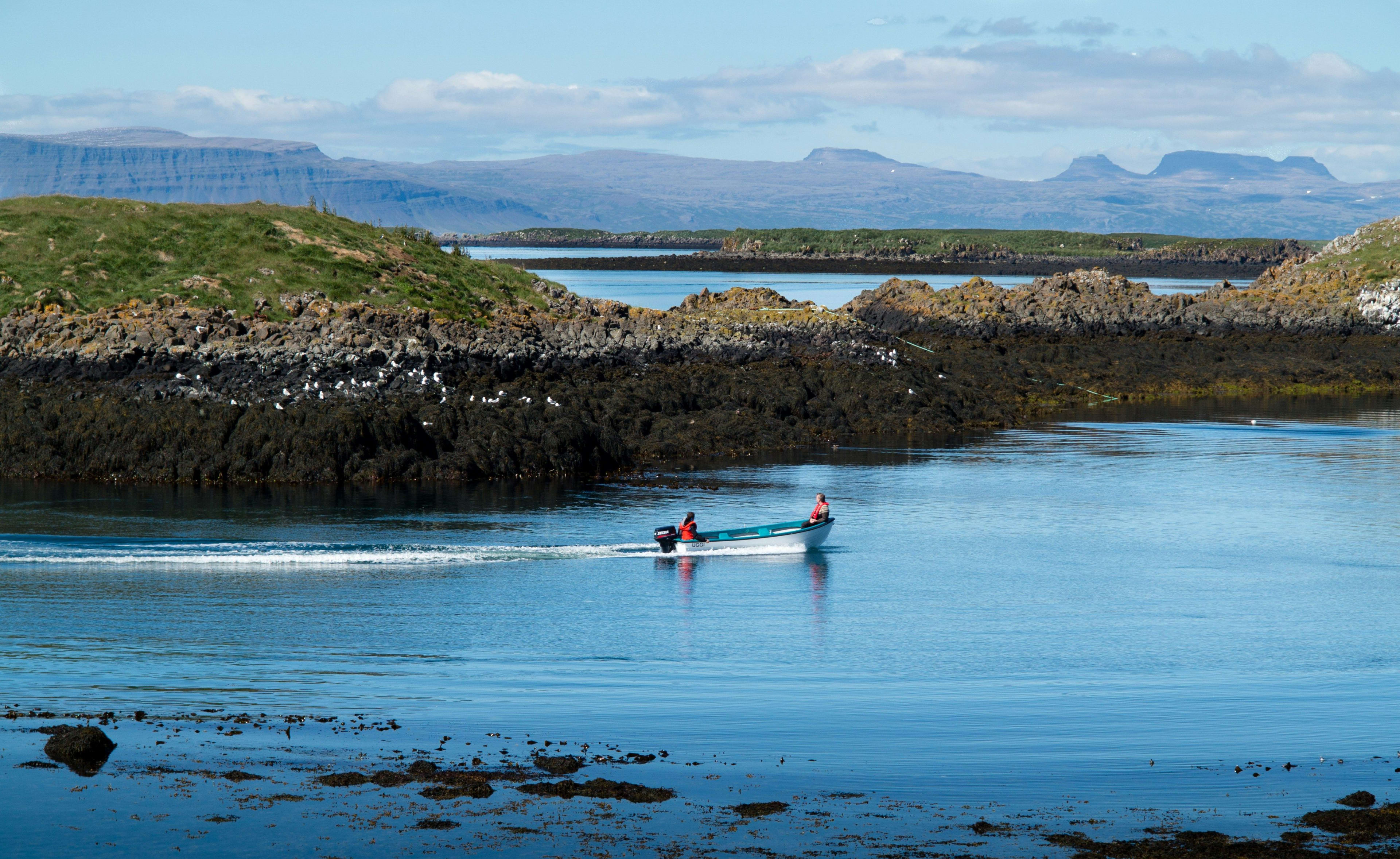
Hornstrandir Nature Reserve
Reason for inclusion: Attention, nature and wildlife lovers! Embarking in the wilderness, wandering between heaven and earth—that's what Hornstrandir Nature Reserve is all about ! Located at the far end of the isolated Westfjords, this secluded reserve covers 580 square kilometers (220 square miles). Towering mountains, steep cliffs plunging into the sea, and endless tundra make it one of Europe's last wilderness areas! This true wilderness is home to a diverse array of wildlife. You'll find many amazing Icelandic animals here, including nesting puffins and elusive Arctic foxes—they might just appear right in front of you when you turn around!
Location information: Within the Westfjords of Iceland
How to get there: The easiest way to visit is by boat from Ísafjörður . Since it's only accessible by boat, you'll truly feel like you're exploring one of Iceland's most hidden gems!
Rauðasandur Red Beach
Reason for inclusion: Iceland, located in the Atlantic Ocean, is also famous for its beaches. When it comes to beaches, people usually think of Iceland's black sand beaches, but few realize that Iceland has another unique landscape: Rauðasandur Red Sand Beach. Located in the wilderness north of the Westfjords, Rauðasandur Red Sand Beach stretches for over ten kilometers, with pink or red sand lying across the sand. Behind the beach are dark volcanic rocks, surrounded by bright blue waters. Visiting here, the vibrant colors make you feel as if you've entered another world. The color of the sand even changes depending on the time of day and the light.
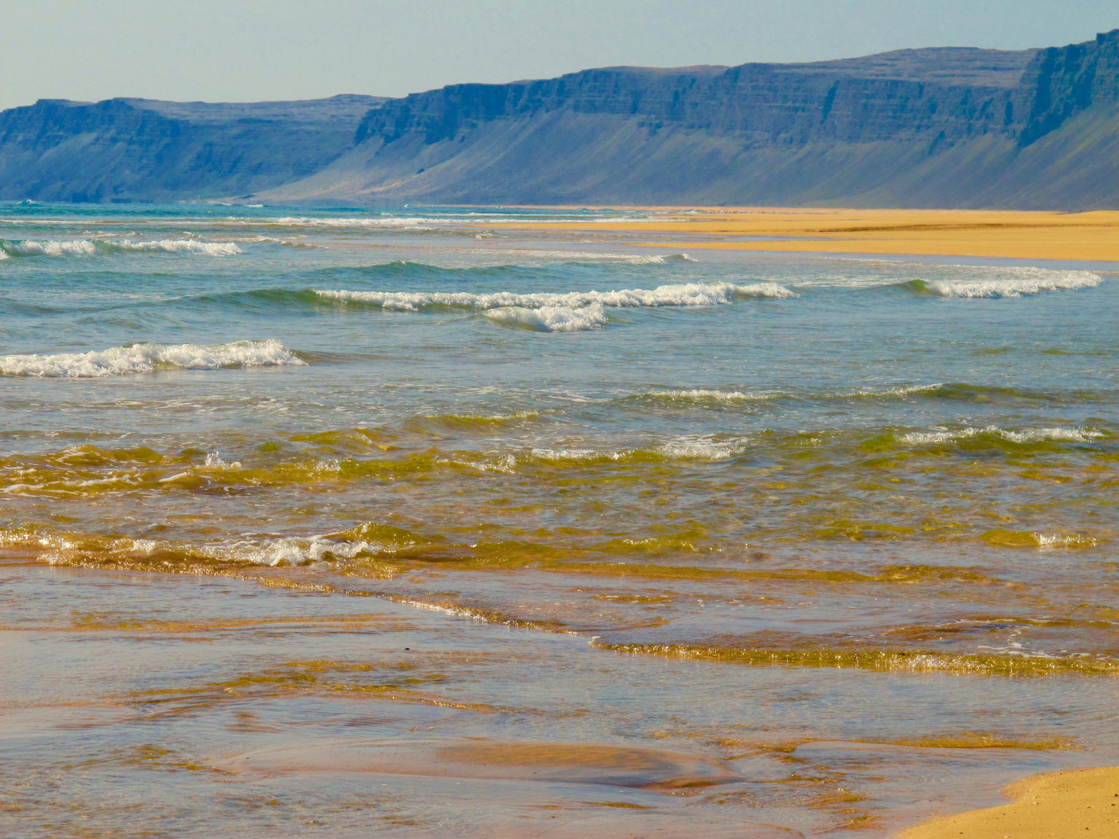
Strolling along Rauðasandur's red sand beach, the soft sand beneath your feet, accompanied by the gentle lapping of the waves, is serene and mysterious. The endless expanse of red sand beats like the heartbeat of the earth, pulsating with nature's primal rhythm. The red sand here isn't a fiery, intense red, but a deep, understated shade, as if the passion deep within a volcano has been tempered by time. Each grain of sand that slips under your feet seems to tell a story of Iceland.
Moreover, Rauðasandur Red Beach is also a fantastic spot to watch the sunset. As the sun slowly sinks, the clouds on the horizon are tinged with golden light, and the entire beach seems to be enveloped in the gentle glow of the evening sky.
Location information: Within the Westfjords of Iceland
How to get there: By car or by tour group
Important notes for visitors: The road leading here is unpaved and winding, so drive carefully! Reaching here requires traversing a steep and winding road, but it's absolutely worth it!
Related Itinerary: 14-Day Self-Drive Tour of Iceland in Summer
Practical Tips for Exploring Off-the-Beaten-Path Destinations in Iceland
Visiting these less-traveled, off-the-beaten-path spots in Iceland is unique and unforgettable. However, ensuring a safe and enjoyable trip requires some preparation. Here are some helpful tips:
1. Safety First: Before setting off on your adventure, always check the weather and road conditions. Always have a reliable GPS device or app, as remote areas may lack clear signage, and some places may require a four-wheel drive vehicle. Furthermore, if venturing into more remote areas, never risk leaving marked roads. Fill up your tank whenever you pass a gas station, as gas stations may be scarce in remote areas. (Related articles: Iceland Self-Driving Guide , Iceland Self-Driving Refueling Tips )
2. Dress appropriately and bring supplies: Iceland's weather changes rapidly and is unpredictable. Being prepared with layered clothing, including waterproof and warm garments and sturdy boots, is crucial. Bringing plenty of energy-boosting food and drinks will also keep you energized and hydrated throughout your adventure. (See: Iceland Clothing Guide for details )
3. Respect the Environment: Iceland's natural scenery is breathtaking. To ensure its preservation for generations to come, please follow the guidelines at all times and adhere to the "Leave No Trace" principle, ensuring you do not litter, damage plants and animals, and protect Iceland's natural environment. (Related article: Things You Absolutely Shouldn't Do When Traveling to Iceland )
Conclusion
Iceland's beauty extends far beyond its well-known landmarks; its soul lies hidden in its remote corners, waiting for true explorers to unveil its secrets. From the tranquil Whalefjord to the deep Ragnaros Valley, from secluded waterfalls to ancient Icelandic fishing villages, these lesser-known destinations tell Iceland's story in their own unique ways—a story of pristine, unspoiled natural beauty.
Escape the hustle and bustle of popular tourist spots like Gullfoss and black sand beaches, and explore Iceland's lesser-known destinations. Every step you take is a dialogue with the soul of this land; every glance you cast is a profound understanding of nature's beauty…
Related itinerary: